
Weather update: Wednesday May 27th 4:30pm

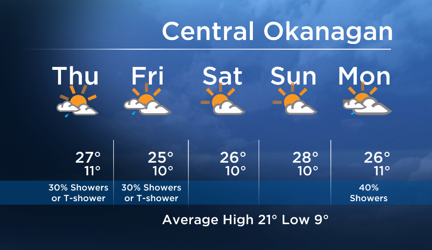
The next couple of days will consist of morning sun with an afternoon shower risk. An upper low will track down the coast and into the BC Interior on Thursday and Friday. The low will stall over the BC Interior until Saturday, keeping a chance of isolated showers or thundershowers in the forecast for the remainder of the work week, especially in the afternoon hours.
Breaking news from Canada and around the world
sent to your email, as it happens.
The low weakens this weekend, reducing the precipitation risk.


Thursday’s daytime high range: 22 to 28C
More details coming up at 5, 6:30 and 11pm!
~ Duane/Wesla
More on Canada
- Toronto’s construction season traffic is ‘unacceptable.’ Is there a better way?
- More foreign interference action coming after inquiry report, India arrests: LeBlanc
- Why MP questions put the Bank of Canada governor in a political minefield
- Amid bird flu spread, Canada boosts surveillance and testing at border
Comments