
Weather update: Thursday January 15th 5am

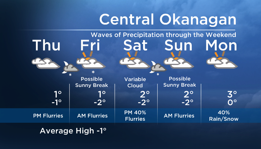
A couple of systems will cross our region starting tonight and through the weekend, bringing waves of precipitation to the BC Southern Interior over the next few days.
Breaking news from Canada and around the world
sent to your email, as it happens.
A dry start today, but most areas will see flurries this evening and wake up to a trace to 3cm of snow tomorrow.
We will stay under a moist southwesterly flow aloft through the weekend, and this will keep temperatures mild and also drive freezing levels up. By Sunday we will likely see precipitation fall as a mix of rain/snow.


Details coming up at 5, 6:30 and 11pm!
Today ‘s daytime high range: -2 to +3C
~ Duane/Wesla
Comments