

TORONTO – From ice storms, to hurricanes, to hail to a winter that many Canadians never thought was going to end. Environment Canada released its Top 10 weather stories of 2014.

How many can you remember?
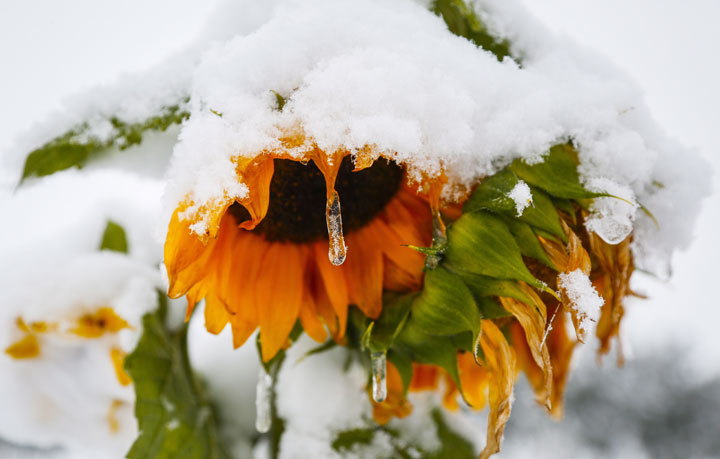
1. Canada’s long, Cold Winter
It was the winter that brought us the words “polar vortex.”
The cold started to ease in at the end of 2013, but it really hit in the new year. In fact on Jan. 1, Ottawa was a frigid -25 C when just days before it had been a more bearable -8 C.
And the cold was persistent right across the country, aside from in British Columbia. From Alberta to the Maritimes, cold Arctic air refused to let up straight through to the spring.
But nobody had it worse than Winnipeg with temperatures averaging -20 C from December to March, and snow totalling 155 cm.
The winter of 2014 isn’t one that Canadians will soon forget.

2. Summer Flooding in Eastern Prairies
On June 15 large slow-moving low pressure systems brought more than a year’s worth of rain in some parts along the Saskatchewan-Manitoba border. The ground became saturated and rivers and creeks crested.
For Saskatoon, it was the city’s third wettest spring. In Brandon, June was the wettest month in the city’s records. And in Regina, nearly triple the amount of rain fell.

3. Wildfires in West and Northwest
Wildfires were once again abundant across the Northwest Territories and northern B.C. in 2014.
Though fewer fires burned, the area burned was three times higher than the 20-year national average with 4.6 million hectares charred. In B.C. alone, fires burned more than 338,000 hectares, seven-and-a-half times the normal 20-year average.

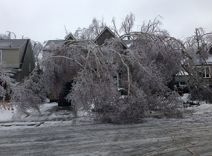
4. The Nightmare Before, During and After Christmas

Get breaking National news
It was a Christmas many won’t soon forget.
It all started in the late hours of Dec. 20 and didn’t end until two days later. Between 20 and 30 mm of freezing rain fell in an area from Windsor all the way to the Maritimes.
The rain coated trees and hydro wires, leaving about a million people without power. In New Brunswick, some residents didn’t have power for 11 days.
5. Summer — Hot on the Coasts, Cool in the Centre
After a terrible winter, many were looking forward to the hot days of summer. And it came, just not for everyone.
The Pacific coast had its hottest summer in 67 years. But from parts of Saskatchewan through to Quebec, it was anything but a steamy summer. The heat and humidity was missing from southern Ontario, which may have been a good thing. But after a particularly harsh winter, many felt cheated.
READ MORE: Polar vortex in summer? Not quite
Still, the country’s summer was 1 C above average, making it the sixth-warmest since record-keeping began in 1948.

6. Hurricane Arthur and Others
The Atlantic hurricane season may have been a quiet one, but eastern Canada didn’t get away scot-free.
After attaining tropical storm status on July 1, Arthur gained strength and became a hurricane on July 3 off the coast of South Carolina. It continued northeast finally reaching Nova Scotia on July 4 as a post-tropical storm. The storm moved northeastward to the Fundy coast and then to Prince Edward Island. As much as 150 mm of rain fell in some places.
The region also endured the remnants of Tropical Storm Bertha in August and Hurricane Gonzalo in October.
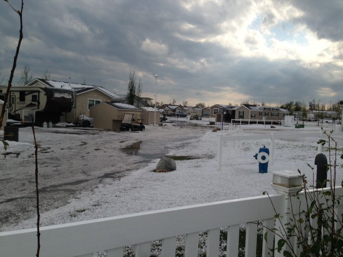
7. Airdrie to Calgary Hailer
On Aug. 8 a large thunderstorm formed along the foothills of Alberta and moved east. That severe storm brought winds of 110 to 140 km/h. But what made it particularly impressive was the tennis- to baseball-sized hail that fell in an area that was 300 km long.
In Airdrie, Alberta, six people were sent to hospital after being hit with the large hail.
After all was said and done, there was more than $450 million of damage to homes and buildings.
8. Powerful December Storms on West and East Coasts
Before winter had even started many Canadians had already seen significant December storms.
In B.C., an intense series of three storms brought heavy rains and floods to Vancouver Island and the province’s central and south coast. Winds near 100 km/h howled across the region. In Courtney, 250 mm of rain resulted in a state of emergency.
Meanwhile, on the east coast, a powerful system moved up the eastern seaboard of the United States. It brought three days of rain, snow and mixed precipitation to New Brunswick, Nova Scotia and parts of Quebec. Moncton received 142 mm of rain in just 24 hours.

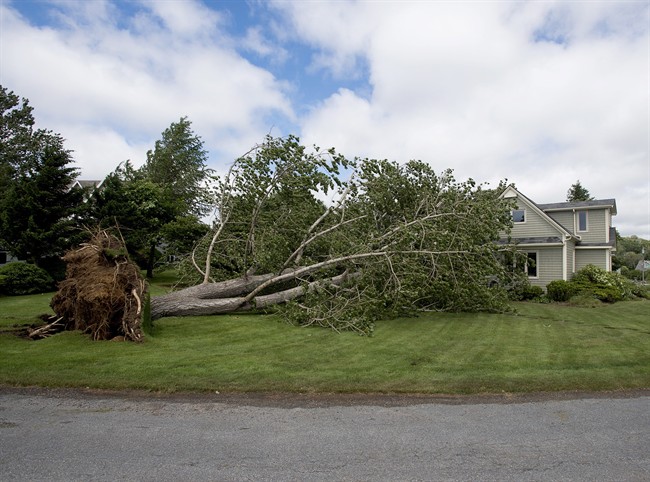
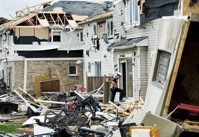
9. Angus Tornado
Ontario saw an active tornado season, though most of them were weak. However, on June 17, an EF2 tornado hit the town of Angus, about 20 km southwest of Barrie. Fortunately there were no deaths, but high winds damaged more than 100 homes and left 300 homeless.
10. “Snowtember” in Calgary
Weather in Canada can change drastically from one day to the next. But nowhere was that more evident than in Calgary on Sept. 8. After enjoying a sunny day where temperatures reached 25 C, residents woke up to a chilly 10 C. And over the next three days, 40 cm of snow fell. It was the highest September snowfall before the equinox in the last 130 years.
Of course, just over a week later, temperatures returned to 25 C.
You can read Environment Canada’s Top 10 Weather Stories for 2014 here.
Comments