
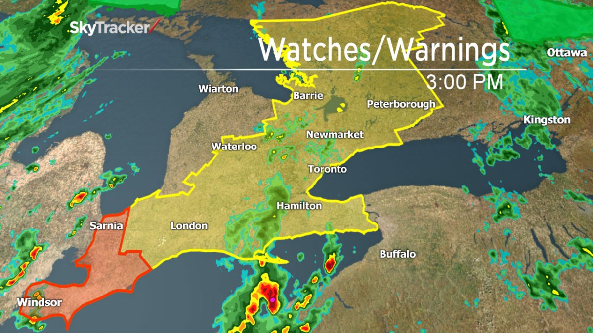
TORONTO – Environment Canada has issued severe thunderstorm watches from southern Ontario to eastern Ontario.

A severe thunderstorm warning that was issued for the Sarnia and Windsor areas, including Chatham-Kent in the afternoon was dropped just before 5 p.m.
However, a severe thunderstorm warning was issued for Barrie, Collingwood, Hillsdale, Orillia, Lagoon City, Washago, Innisfil, New Tecumseth and Angus at 4:50 p.m. Strong wind gusts hail and heavy rain were among the main threats.
Barrie – Collingwood – Hillsdale
Orillia – Lagoon City – Washago
A cold front is approaching from the west which is triggering thunderstorms ahead of it. The main threat is the potential for heavy rainfall of up to 50 mm an hour, as well as strong wind and hail.

Get daily National news
READ MORE: Ontario records its 13th tornado of the season
The areas under the watch are:
- Sarnia – Lambton
- Windsor – Leamingt0n – Essex County
- Simcoe – Delhi – Norfolk
- Dunnville – Caledonia – Haldimand
- Niagara, Ont
- Chatham-Kent – Rondeau Park
- London – Middlesex
- Elgin
- Oxford – Brant
- City of Toronto
- York – Durham
- Barrie – Orillia – Midland
- Bayfield Inlet – Dunchurch
- Parry Sound – Muskoka
- Haliburton – Minden – Southern Haliburton County
- Peterborough – Kawartha Lakes
- City of Hamilton
- Listowel – Milverton – Northern Perth County
- Stratford – Mitchell – Southern Perth County
- Waterloo – Wellington
- Dufferin – Innisfil
- Halton – Peel
Remember to keep an eye on the sky. If threatening weather approaches, seek shelter. As well, keep away from flooding roads: it’s often difficult to ascertain just how deep the water is and it can pose a danger.
A watch is issued when conditions are favourable for severe weather. A warning is when hazardous weather is imminent or occurring.
BELOW: Is the stormy weather going to slow your drive home this afternoon?
To get real-time weather for your area, download the Global News Skytracker weather app.
Comments