
Thursday’s storms that swept across Calgary and Airdrie produced some incredible rain and hail, and even reports of a tornado.

However, there is the possibility that it was a gustnado and not a tornado.
What’s the difference?
READ MORE: Several severe storms strike Airdrie
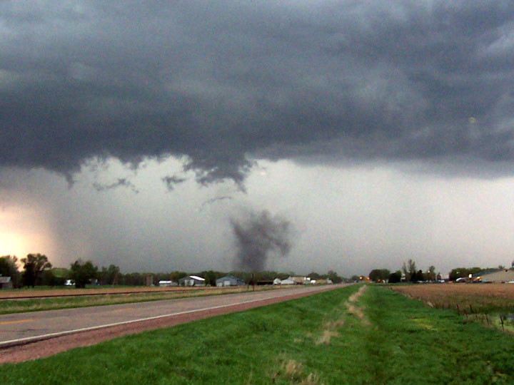
Gustnadoes are borne from severe storms, however, they are much weaker than their tornadic cousin. They are created from gust fronts and – as opposed to tornadoes, which occur at the rear of a mesocyclone – occur at the leading edge of storms.

Get breaking National news
Gust fronts form as relatively dry air in the lower atmosphere causes the rain ahead of it to evaporate. This cools the air, which sinks. It causes a downrush of air – the outflow – that spreads out at ground level. With some instability at ground level, like wind shear – the change of wind speeds or direction – rotation may occur. A gustnado is born.
Whereas tornadoes form from mid-level winds in the atmosphere, gustnadoes form from low-level winds and are normally short-lived. It may be easier to think of a tornado as forming from the cloud down and the gustnado as forming from the ground up.
Gustandoes aren’t as strong as their tornadic cousins, though they can create winds of around 64 km/h, which would make it an EF0 on the Enhanced Fujita scale.
If you see any strong winds or rotating clouds, take shelter immediately. You could be injured by flying debris.
To get real-time weather for your area, download the Global News Skytracker weather app.


Comments
Want to discuss? Please read our Commenting Policy first.