A second cold front swept down from northern Ontario on Sunday and severe thunderstorms started forming along the boundary of the cool air sinking south.

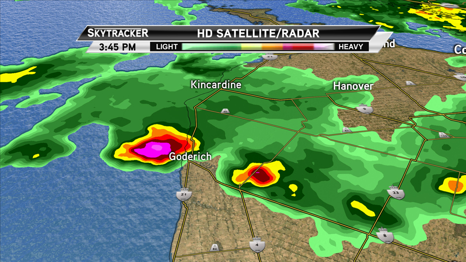
A strong supercell storm formed on the Michigan side of Lake Huron around 2:00 p.m. on Sunday. This storm intensified and began to rotate, right before moving back over land and right over the Goderich area.

Get breaking National news
Because the storm was initially over water, no ground observations were available to confirm a tornado was in the storm — but there was enough rotation on the radar for Environment Canada to issue a Tornado Warning 10 minutes before the tornado hit.
This was a particularly intense storm, stronger than the one that swept through Vaughan and Woodbridge in 2009. After observing some of the damage and destruction yesterday, Environment Canada believes it is a strong F2 or weak F3 tornado.


This type of storm is rare for Ontario and almost unheard of in Goderich.
The storms lost intensity as they moved from Goderich to Toronto but minor damage was reported in many cities across southern Ontario.
Anthony Farnell
Global Toronto Meteorologist
.jpg?h=article-hero-560-keepratio&w=article-hero-small-keepratio&crop=1&quality=70&strip=all)


Comments
Want to discuss? Please read our Commenting Policy first.