
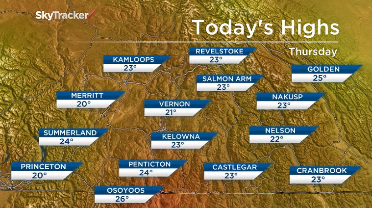
Weather update: Thursday June 19 4:15pm

A Pacific frontal system pushing onshore brought parts of the Southern Interior midday clouds.
However the weak warm front that these clouds are associated with was too weak to bring much precipitation and we only saw a few very isolated sprinkles for the northern areas of our broadcast region Thursday.
For those of you in the Southern region, the clouds cleared earlier helping to warm up the temps.
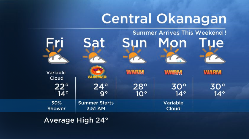
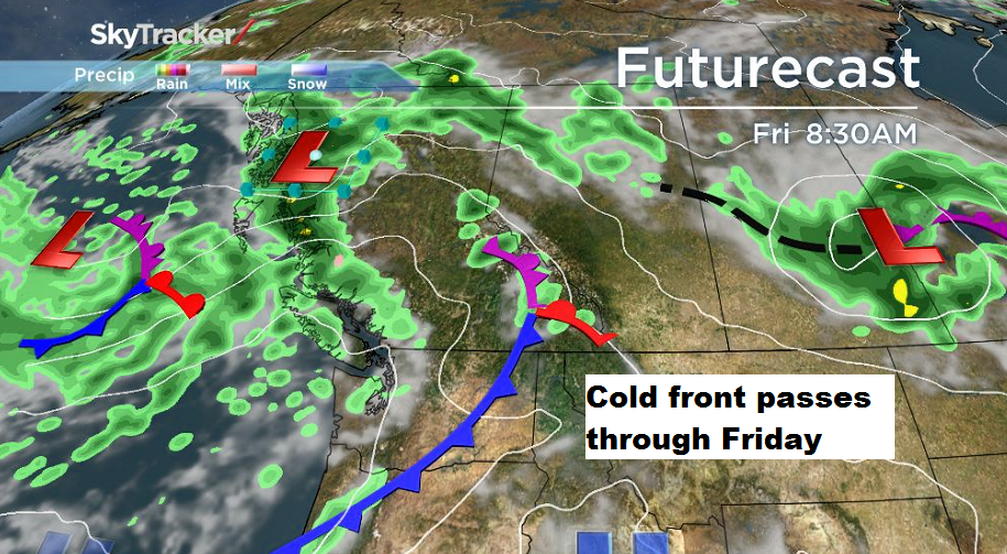
Looking ahead for Friday, the cold front that is a part of the same system will cross our area in the morning hours.
It will be breezy at times Friday with temperatures near seasonal or slightly below with cloud and some sun in the mix.


- ‘Shock and disbelief’ after Manitoba school trustee’s Indigenous comments
- Canadian man dies during Texas Ironman event. His widow wants answers as to why
- Several baby products have been recalled by Health Canada. Here’s the list
- ‘Sciatica was gone’: hospital performs robot-assisted spinal surgery in Canadian first
There will be a 30% chance of showers tomorrow with the passage of this cold front.
The Boundary, Arrow Lakes, and Columbia regions will see a slightly higher chance of showers.
We are still on track to a dry weather pattern with a mix of sun and cloud this weekend – temperatures will warm up above seasonal once again, and by Sunday temperatures will be in the upper 20’s or low 30’s.
Friday’s High: 19 to 25C
~Duane/Wesla
Comments