
After days of warming weather and gentler conditions, large parts of southern Ontario are set for another cold snap, which will bring more snow and freezing rain from Wednesday.

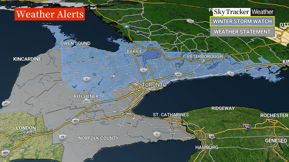
Weather warnings and advisories stretch from Windsor through Hamilton, Barrie and as far east as Belleville. They include fog, freezing rain and snow.
“The recent calm weather pattern will come to an abrupt end on Wednesday as a frontal system arrives from California,” Global News’ chief meteorologist Anthony Farnell explained.
“Significant amounts of snow, freezing rain and even rain are likely across parts of southern Ontario, with the GTA in line potentially for all three.”

Get daily National news
An orange weather alert for the Kitchener area, for example, predicts “significant” freezing rain, with ice accretion of five to 10 mm likely. Winds could hit as high as 60 km/h.
The prediction in Toronto itself is less severe, with a special weather statement for “hazardous winter conditions” including up to five cm of snow, reduced visiblity and ice pellets.
Some areas — and those that already have significant snow on the ground — could see more.
“The temperature at the surface and also a little higher in the atmosphere will play a crucial role in the precipitation type — and right now I would expect areas that stay mostly snow — (and could) end up with 15 to 20 cm by the end of Wednesday,” Farnell added.


“The highest snow totals will be where a winter storm watch is currently in place.”
Farnell said snow would giveway to ice heading west from Toronto into Hamilton, Kitchener and Guelph.
Comments
Want to discuss? Please read our Commenting Policy first.