
REGINA – Rising water levels prompted a warning Tuesday that large parts of southern Saskatchewan could see near-record flooding.

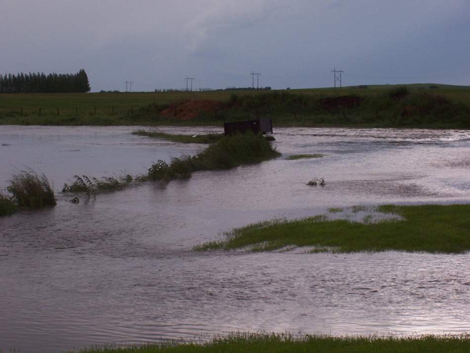
The Saskatchewan Watershed Authority said very high levels in the Qu’Appelle River are expected to overflow onto the flood plain along the entire Qu’Appelle valley. The river runs from Lake Diefenbaker, northwest of Regina, across Saskatchewan to the Manitoba boundary.
Authority spokesman John Fahlman said they had to revise their forecast because there had been more water than previously anticipated.
"Now, rather than basically a one in 25-year event through the Qu’Appelle system, we’re saying it’s going to be higher. Basically closer – at least in the upper reaches – to what we had in the ’70s, which was a significant year," said Fahlman.
"For example, at Lumsden we have about 100 years of record and what we’re predicting now would be the second highest in that 100 years."
Fahlman said in 1974, the peak flows in the Qu’Appelle River at Lumsden were more than 450 cubic metres per second. It’s expected to be around 300 cubic metres per second this time.
"It’s just going to be big. But once it gets that high it just fills up the valley and spreads out."
According to Public Safety Canada’s website, the 1974 flood caused an estimated $23.4 million damage, adjusted for the value of the dollar in the year 2000. In Moose Jaw, 60 city blocks were under water; bridges and dams were damaged.

Get breaking National news
Fahlman said a lot of communities have since put in flood protection measures. Some places, such as the town of Lumsden, should be protected.
But numerous roads crossing the valley will be over-topped. Towns, villages and rural property owners should brace themselves, he said.
"Anybody living along the lakes in the Qu’Appelle chain need to know how much the water level’s going to rise from what they currently are and also that as the ice breaks up it could be damaging, too. So, they need to do what they can to move their things above where the predicted levels will be," said Fahlman.
The All Nations’ Healing Hospital in Fort Qu’Appelle was evacuated Tuesday because a nearby creek spilled its banks.
"There’s no water in the facility itself – it’s access. To be able to access the facility you have to see the road and the roads are under water," said Gail Boehme, executive director of the hospital.
Boehme said nine patients have been evacuated by ambulance to other facilities. She doesn’t know how long the hospital’s doors will be closed.
"Hopefully we’ll be up and operational as soon as possible. For the time being though, the hospital is closed and we are on what is called ‘bypass’ here until further notice."
The hospital serves 15,000 to 20,000 people in the town of Fort Qu’Appelle and the surrounding area.
The watershed authority has warned that all of southern Saskatchewan will see high water levels because of a wet summer and fall in 2010 and more snow than usual this winter.
High flows in the Moose Jaw River are causing backflows into Buffalo Pound Lake, which joins up with the Qu’Appelle River. The watershed authority said the lake has risen more than one metre and is projected to rise at least another metre, peaking at levels not seen since the 1970s.
The water is also rising to the west in Swift Current, where the city has sandbags and other flood barriers in place to hold back the creek.
In southeastern Saskatchewan, the outflow from Boundary Dam at Estevan has been increased several times since Monday because the reservoir continue to peak. Those rising water levels are expected to affect some roads and properties in low-lying areas may experience flooding, said the authority.
Officials with Saskatchewan’s Ministry of Corrections, Public Safety and Policing said Tuesday that the town of Radville, about 137 kilometres south of Regina, has declared a local state of emergency.
Rising floodwaters forced the closure of part of the Trans-Canada Highway in southeastern Saskatchewan on Tuesday. Highway officials said the westbound lanes were submerged near the town of Wolseley, about 100 kilometres east of Regina.
The RCMP had warned motorists to be careful because the eastbound lane of the highway near Grenfell was under water, too. Grenfell is about 120 kilometres east of Regina.
The big question is when the floodwaters will peak.
"It depends on weather. It depends on a lot of things. What we do know is that starting now it’s just going to continue to rise," said Fahlman.
"It’ll take a few days to a few weeks to materialize and to do what we think it’s going to."
Comments
Want to discuss? Please read our Commenting Policy first.