
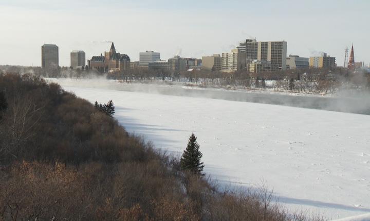
SASKATOON – Relief is on the way for Saskatoon residents after having their fair share of time in a deep freeze so far this winter.

With dangerous wind chills over the weekend in Saskatchewan dipping into the minus 50s, Monday’s mild warm-up finally reached the minus 20s – the warmest in days.
Midday Monday also marked the first time in three days that wind chill warnings were not blanketed across much of the province.
As residents know all to well, winter has been no stranger in Saskatchewan so far this season.
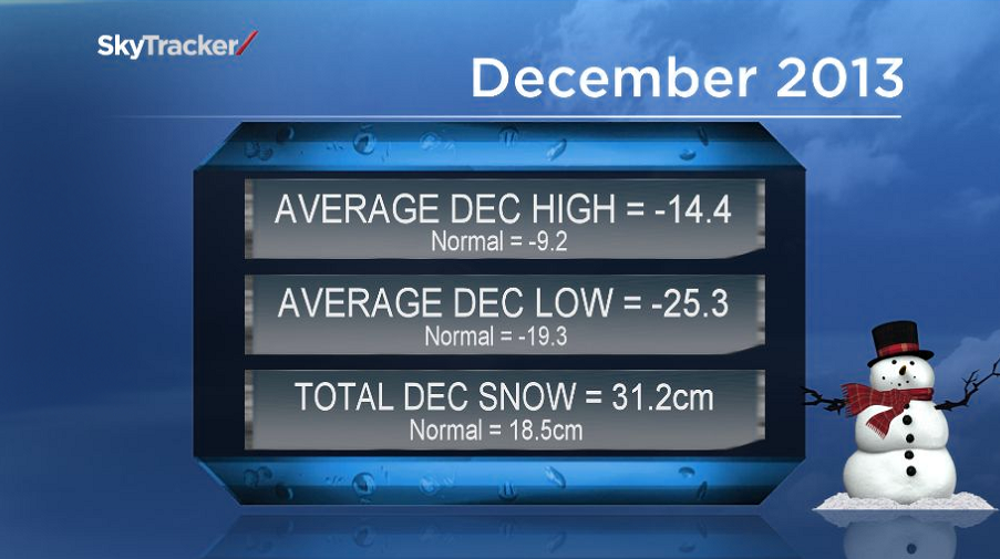
The city kicked off the winter season colder and snowier than normal.
The overall average temperature throughout December was minus 20, over 5 degrees colder than the normal average of minus 14.3.
Usually around 18.5 centimetres of snow falls during December, however last month brought approximately 31.2 cm.
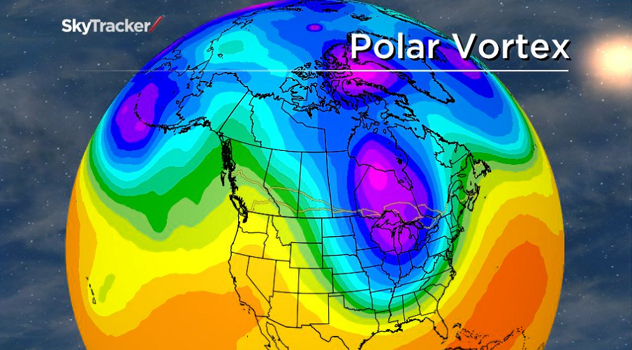
The culprit of the most recent cold snap was a “polar vortex”, which is a dome of arctic air in the upper atmosphere that usually sits over the North Pole, but was pulled down via a jet stream.

Get breaking National news
This arctic invasion was different than Saskatoon’s usual cold outbreaks because the cold air caught much of North America in a wintery grip.
Wind chill warnings were issued as far south as Florida and even states bordering Mexico saw minus 20 readings.
With conditions becoming more bearable in Saskatoon, many are wondering if we can expect the milder trend to continue.
In the short term, the answer is yes.
After a chilly start Wednesday morning, a warming trend will bring above seasonal temperatures to the Bridge City as soon as Thursday, with the mercury approaching the freezing point by the weekend.
With recent snowfalls sticking to road surfaces combined with scattered flurry activity, more icy road conditions can be expected as some melting on road surfaces will likely take place.
Download the SkyTracker Weather App to stay up-to-date with the latest weather conditions, warnings and watches.


Comments
Want to discuss? Please read our Commenting Policy first.