

An Edmonton-based space tech company made up of University of Alberta alumni is uncovering new insight into the planet with the first-ever commercial hyperspectral satellite.

But what exactly is that? It sounds complicated but Chris Robson, the co-founder and CEO of Wyvern, offered a simple way to think about it.
“Imagine if you and I were on an airplane looking down. We would see forests and rivers and mountains, but if you could see with hyperspectral eyes, you wouldn’t just see a forest,” Robson said.
“You would see all the species of trees, you would see if there’s a pine beetle infestation, you would see how much water, moisture is in the dirt, in the vegetation.”
Robson holds a masters in mechanical engineering from the U of A, where he studied aerodynamic attitude control systems.
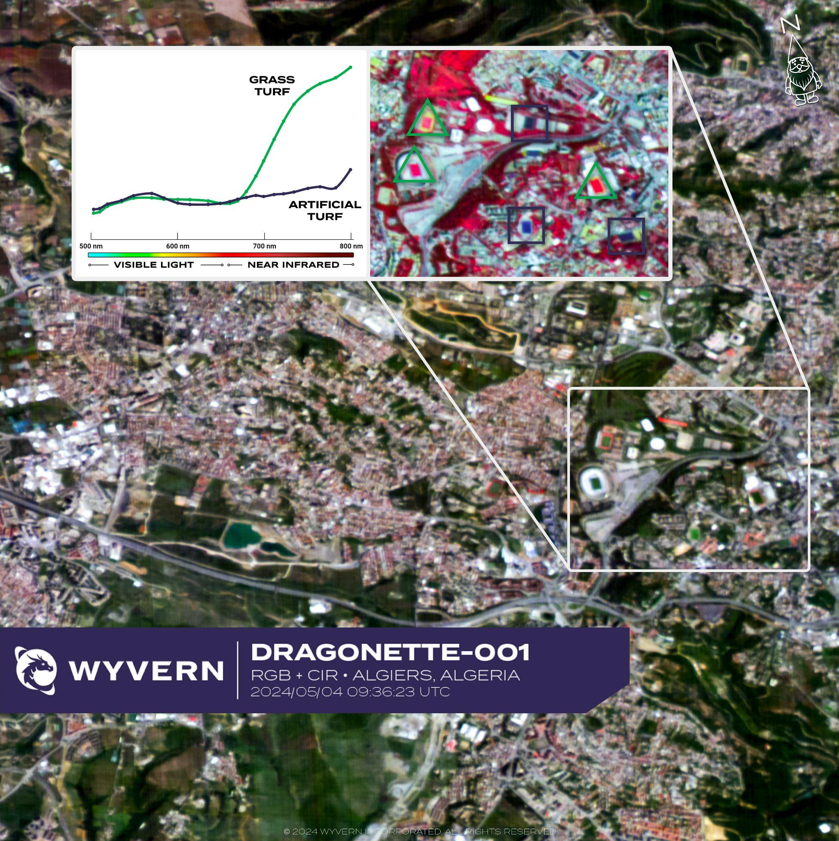
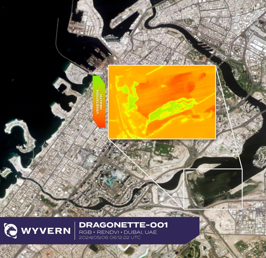
A hyperspectral map looks like an infrared heat map — but in the case of the map pictured above, different colours represent things like moisture levels, vegetation, and a camouflage vehicle hiding on the edge of a forest.


“These colour bands are the things that allow you to figure out what sort of chemistry is going on and is happening inside of a pixel,” Robson said.
According to Robson, the types of hyperspectral images above can be useful for all sorts of sectors, including agriculture, mining, insurance and government defence.
“If you’re in forestry, it’s figuring out exactly what sort of timber inventory you have or the risk of wildfire. If you’re in energy it’s environmental remediation, it’s also measuring how much methane is leaking from your infrastructure,” Robson said.

Get breaking National news
“There’s lots of applications; with hyperspectral there are literally thousands.”


Images are captured using Wyvern’s Dragonette satellites. The company said it’s a game-changer for the industry — the first commercial hyperspectral satellite company in the world.
“We started this with a goal of building a better Earth from space by being able to figure out exactly what’s going on earth on any given day,” Robson said.
Wyvern launched its first three Dragonette satellites last year, aboard SpaceX rockets.
Its satellites orbit Earth 15 times a day and visit the same place on Earth every three days. It takes up to six hours to get one image.
“We have three more satellites on the way right now that’ll bring the current constellation up to six,” said Callie Lissinna, engineer and co-founder of Wyvern who also has a degree in mechanical engineering with a mathematics minor from the University of Alberta.
The team said their satellites are a cheaper alternative to drone imagery.
“It takes a lot of work to cover a very small area with a drone. Our satellites can take a 400-square-kilometre image in a few seconds,” Robson said.
“We can discover all kinds of new insights about the world, now that we have this brand-new information available for the first time,” Lissinna said.
Comments
Want to discuss? Please read our Commenting Policy first.