

As I write this, temperatures are once again soaring into the 30s and the humidex will once again reach 40-plus across southern Ontario.

All of this before the summer solstice and the official start to our “hot weather season.”
The first heat dome will be weakening by the weekend, but it is a troubling sign and perhaps a precursor to what lies ahead this summer.
There is almost universal support for a hotter than normal summer across the province, with the biggest deviations likely across the north and eastern parts of Ontario towards Quebec.
The two areas most prone to heat domes and drier weather this summer will be Eastern Canada and across the southwest U.S. into the plains.

At times, these two areas will link up, creating a conveyor belt of heat and humidity originating over the Gulf of Mexico, moving all the way up to Ontario.
An active thunderstorm season is likely around the Great Lakes thanks to frequent “ring of fire” storms that will form around the big, hot heat domes.

Get daily National news
These clusters of storms can drop a large amount of rain in a short period of time but also contain damaging winds. They also often occur later in the evening or overnight.
Above normal precipitation is likely through at least early August, with a drying trend after that.
The wet spring across the country combined with an intensifying La Nina means we are not going to see a repeat of the record-setting fire season of 2023. For southern Ontario, this means fresher air and a reduced number of smoke days compared with last year.


The recent trend of warmer and sunnier than normal weather lasting into fall should continue this year thanks, in part, to the record warm North Atlantic.
September and even October will likely remain on the warm side in Ontario, but we will need to watch for any tropical storms or hurricanes that spill moisture back into our region.
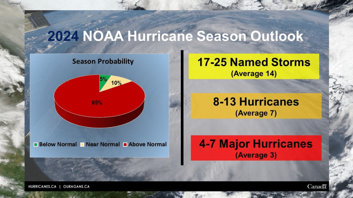
Forecasters at the National Oceanic and Atmospheric Administration are predicting a very active year in the Atlantic with 17 to 25 named storms. The average is just 14.
Comments
Want to discuss? Please read our Commenting Policy first.