

Heavy snowfall has enveloped much of southern B.C., especially in the South Coast region.

Snowfall warnings are in effect, spanning Vancouver Island and the Lower Mainland and Fraser Valley to the border with Alberta.
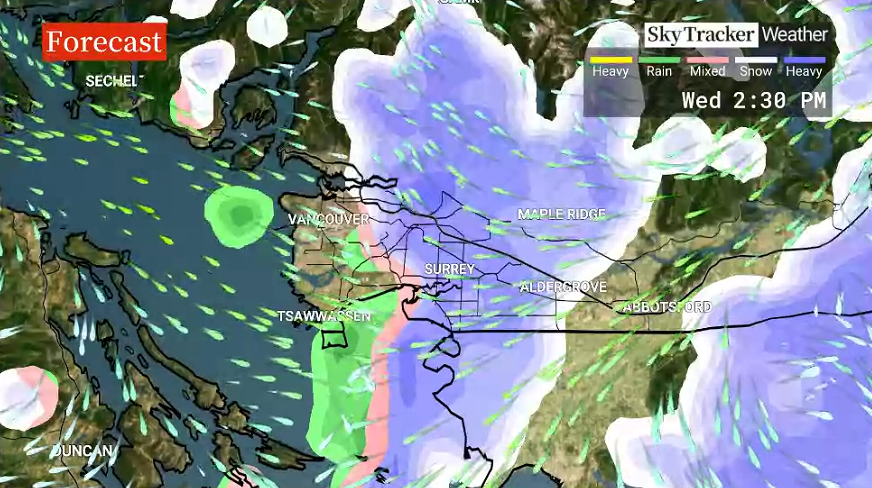
Between 10 cm and 20 cm of snow is expected Wednesday in Metro Vancouver, most of Vancouver Island, Howe Sound, Whistler, Sunshine Coast, Southern Gulf Islands, Sea-to-Sky Squamish to Whistler, Malahat Highway-Goldstream and Mill Bay.
“A Pacific low-pressure system is bringing widespread snow to the south coast (Tuesday night) through (to Wednesday afternoon),” an Environment Canada alert said.
“Snow may become mixed with rain over Greater Victoria (Wednesday) afternoon.”

In addition to the snow, freezing rain is possible for southern B.C., near the U.S. border.
Emergency shelters have been opened by municipal governments in affected areas. It is recommended to check with local government social media accounts and websites for up-to-date information.
Drivers are being warned of deteriorating driving conditions and asked to adjust to rapidly changing road conditions.

Get daily National news
Highways, roads, walkways and parking lots may become difficult to navigate with accumulating snow.
In the Fraser Valley, significant snowfall is also expected. It is forecast that there will be 15 cm to 25 cm accumulations, with cold air blowing in from the east and northeast.
Snow is expected to reach around 10 cm to 20 cm of accumulation in the Okanagan, Fraser Canyon and Similkameen regions.
For the Coquihalla Highway, Hope to Kamloops, and the Okanagan Connector, Merritt to Kelowna, 15 to 25 cm of snow is expected. Visibility can suddenly change and be reduced quickly due to heavy snowfall.
Weather in the mountains can change suddenly resulting in hazardous driving conditions.
Residents who are in snowfall areas are being reminded to clear snow on sidewalks and walkways on their properties, as well.


There have been numerous school district closures around the province due to the snow. Parents and students are recommended to check their local districts and post-secondary schools websites and social media accounts for the most up-to-date information.
Officials at Vancouver International Airport are warning passengers delays and cancellations are possible throughout Wednesday. For the most up-to-date information, it is recommended to check YVR’s website and social media.
“With snow in the forecast today and into the days ahead, safety remains our top priority. While our teams are actively clearing snow and ice from runways and taxiways and operating our de-icing facilities, there will be fewer flights able to arrive and depart in response to winter weather conditions,” YVR staff wrote in an alert.
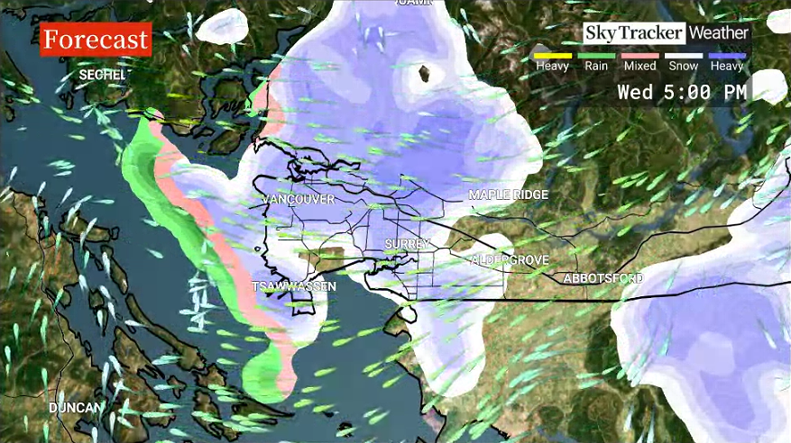
Environment Canada expects snow around southern B.C. to “taper off” Wednesday evening.
Global BC Meteorologist Kristi Gordon gave an updated timeline for the Lower Mainland, late Wednesday morning.
Metro Vancouver can possibly see more snow Wednesday evening, but much less widespread than the morning.
There are concerns for ice on roads overnight and into early Thursday morning. Some snow is also possible, around 5 cm, Thursday as well.

Comments
Want to discuss? Please read our Commenting Policy first.