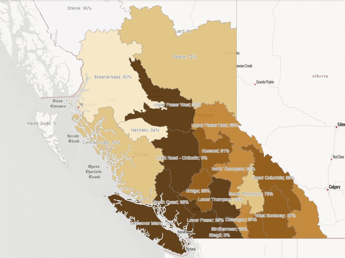
Two weeks after a green Christmas for most of B.C., most of the province has been coloured various shades of brown.

On Wednesday, the River Forecast Centre released its first snowpack map for the year, an annual occurrence in early January.
Normally, snow basin levels throughout the province at this time should be in the 75 to 100 per cent range. This year, however, because of ongoing drought conditions, those levels are nowhere close to normal.
The result: A map mostly covered with various shades of brown (below normal) instead of white (normal) or green (above normal).

For example, Vancouver Island is listed as having just 39 per cent of its regular snowpack levels while the South Coast (36 per cent), Lower Fraser (35 per cent) and Similkameen (32 per cent) regions are even lower.
In B.C.’s Southern Interior, the numbers are higher, but still nowhere near where they should be.
The Okanagan is at 64 per cent with the Boundary region at 58 per cent, followed by the West Kootenays at 57 per cent and East Kootenays at 62 per cent.
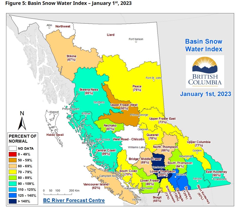
One year ago, Vancouver Island was at 62 per cent of normal, with the South Coast at 70 per cent, the Lower Fraser at 86 per cent and the Okanagan at 135 per cent.
The provincial average in 2023 was 82 per cent of normal.
In 2022, Vancouver Island was at 100 per cent, the South Coast at 106 per cent and the Okanagan at 84 per cent. The provincial average that year was 115 per cent.
- Jan. 1, 2021: 108 per cent provincial average
- Jan. 1, 2020: 84 per cent provincial average
- Jan. 1, 2019: 96 per cent provincial average
- Jan. 1, 2018: 96 per cent provincial average
Last week, the River Forecast Centre noted that the snowfall season got off to a slow start, with October being drier and warmer than normal.
It said, on average, B.C. accumulates 45 per cent of its normal snowpack levels by Jan. 1.
The provincial average was estimated to be 65 per cent, but that was before this week’s snowfall and Thursday’s updated map.

An Okanagan fruit farmer says it could be a costly summer if more snow doesn’t fall.
“If there is warm weather, then we do have to irrigate more and that can be costly for farmers if the city or regional district penalize us for the extra usage,” Mani Gill said.
“So, the biggest issue right now is the low snowpack, no snow in the valley, so it’s going to be super dry if we don’t get anything before the springtime.”
— With files from David Baxter


Comments