

TORONTO – Tornadoes, floods, blizzards and hurricanes. This year, some of the most extreme weather took all shapes and forms, leaving us in awe of the forces of Mother Nature. But it also brought out some of the best in people.

Deadly Oklahoma tornadoes
Oklahoma is no stranger to tornadoes: it lies right in an area dubbed as “tornado alley” known for its frequent twisters each year.
But on May 20, one of the worst tornadoes in the state’s tore across the area.
That day, severe thunderstorms popped up across the state that day, many of which spawned tornadoes.
But it was the town of Moore that experienced one of the worst tornadoes in that state’s history. An EF5 — the strongest on the Enhanced Fujita scale, used to measure the strength of tornadoes — blew houses apart, downed trees, and sent cars and trucks into the air. In the end, 25 people were killed, and hundreds more injured.
That wasn’t the end of it, though.
On May 31, the widest tornado ever recorded — four kilometres — tore through the state again, this time with the deadliest results in El Reno.
Twenty-two people were killed, including eight children. Many people drowned due to heavy rain associated with the storm.
Three of the victims were professional storm chasers, Tim Samaras, his son, Paul, and Carl Young.
Though the tornado was initially rated as an EF5, it was later downgraded to an EF3.
But as with any widespread tragedy, people united and helped rebuild.
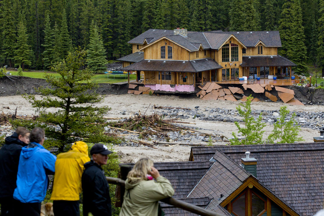
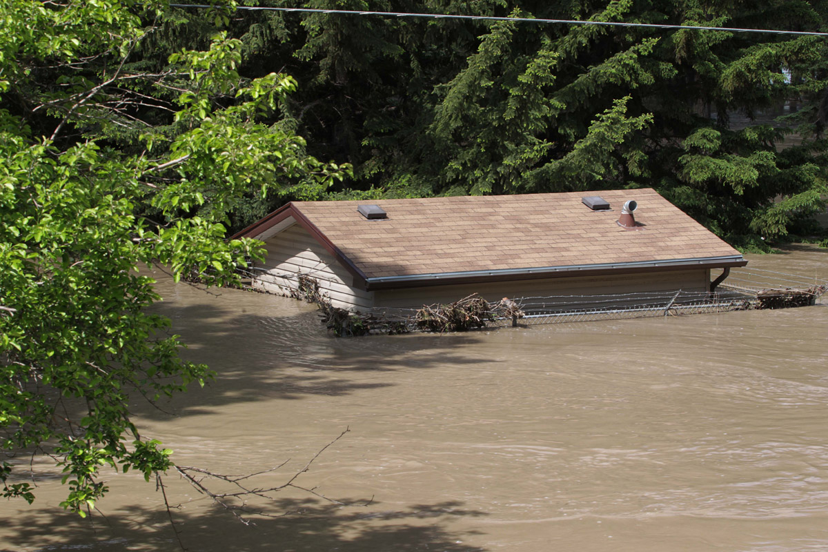
Alberta flooding
It was the worst storm in Alberta’s history, and the costliest.
On June 20, a large weather system moved in from the southwest, dropping nearly 100 mm of rain in just over a day in some areas. The river systems and ground were unable to handle the massive amount of precipitation and rivers crested creating flooding across much of southern Alberta.
READ MORE: Flooding timeline: A devastating, drenching June for Alberta
The rain persisted creating devastating conditions in and around Calgary, including High River and Red Deer. Homes were washed away, people struggled to save their homes and cars, but many were forced out of their homes. At least four people died.
GALLERY: The Alberta flood


Many people were unable to return to their homes or businesses.

Get breaking National news
But an outpouring of support from around the country — in monetary donations and assistance to rebuild, even at Christmas time — eased some of the pain and hardships people had to endure.
The Insurance Bureau of Canada estimated that the flooding was the costliest in Canadian history, topping off at $1.7 billion.
In November, the province announced $37 million for flood recovery.
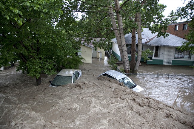
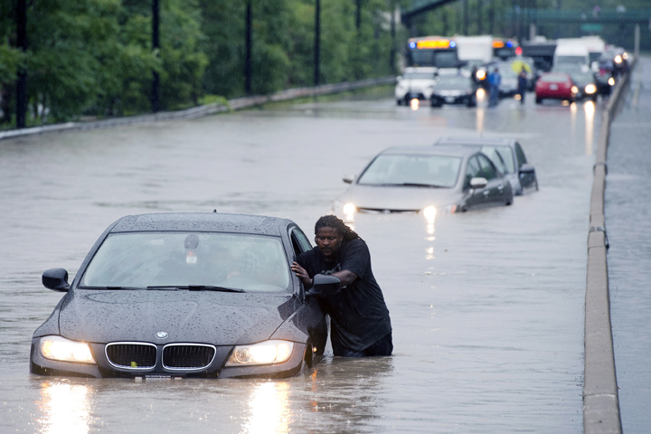
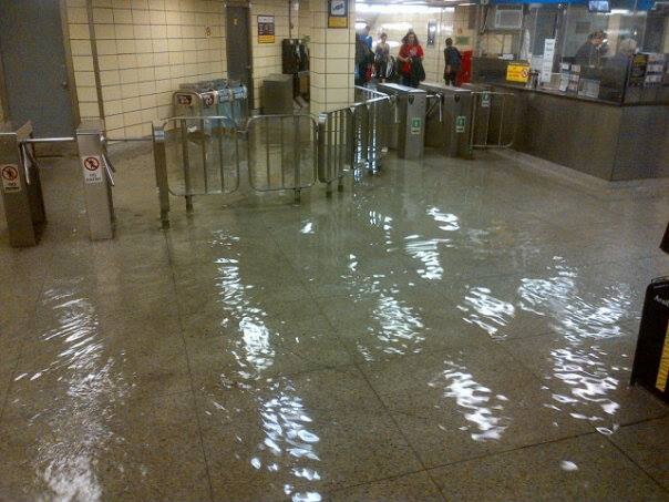
Toronto floods
Although not comparable to the Alberta floods, the flood that affected Toronto was an extreme weather event for the city, something that hadn’t been seen since Hurricane Hazel. Worst still, it took the city by surprise.
On July 8, a warm, humid air mass — which is typical in southern Ontario — settled over the city. The thunderstorm produced rainfall of up to 126 mm at Toronto’s Pearson International Airport. The average rainfall for the entire month is 74 mm.
Gallery: Toronto’s July flood


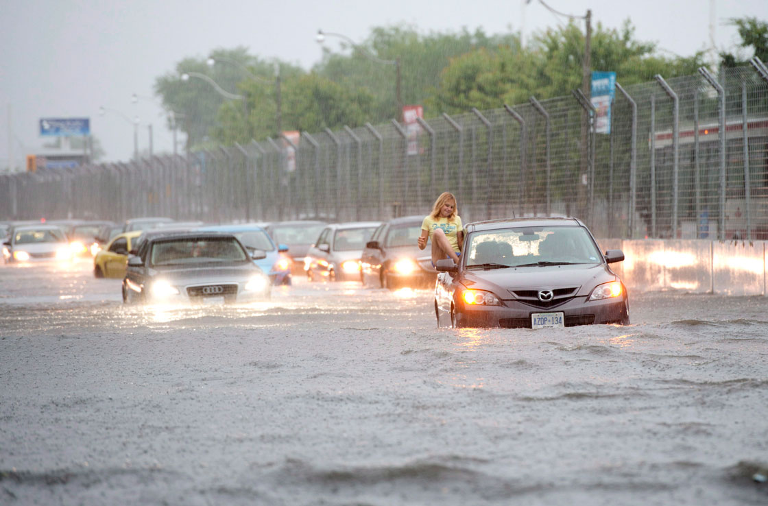


The single day record for rainfall is 121.4 mm set during Hurricane Hazel on October 15, 1954.
More than 300,000 people were left without power, the Don Valley Parkway (DVP) — an essential route into the downtown core — was closed as the Don River broke its banks, flooding the highway, leaving motorists stranded.
Commuters on a GO Transit train became trapped for hours as the flood water overtook the tracks, beside the DVP.
Basements of homes became flooded, roadways were closed. It was a storm that paralyzed the city.
Colorado floods
It could be said that it was the extreme weather year of water.
On Sept. 9, a slow-moving cold front met with a warm and humid air mass and created some heavy and persistent rainfall over the U.S. state.
Thousands of people were forced out of their homes in Blouder and surrounding areas. Seven people were killed.
The rain fell over the area for seven straight days, dropping more than 500 mm. Flash floods washed away cars and homes.
Making things worst was that the floods caused at least 10 oil spills.
Super Typhoon Haiyan
On Nov. 7, one of the most powerful storms ever recorded — Super Typhoon Haiyan — made landfall in the Philippines.
READ MORE: Why Super Typhoon Haiyan was so destructive
The typhoon wasn’t so much large, as it was powerful: the maximum sustained wind speed was 315 km/h.
Thousands of people were forced out of their homes and more than 6,000 were killed. The death toll could creep higher as the country continues to recover bodies.
One of the worst hit towns was Tacloban, where thousands are believed to have died.
People from around the world, including many in Canada, helped to launch or contribute some aid to the victims of the storm.
READ MORE: Harper announces another $15M for Philippine relief
Haiyan was the deadliest natural disaster in Philippines history.
Western blizzards/deep freeze
Alberta knows its winter storms. But the storm that hit the southern part of the province on Dec. 2 packed quite a punch.
It came out of the south, but it didn’t bring any southern temperatures with it.
Instead it brought a lot of moisture and strong winds creating blizzard conditions.
What made it worse was that the system hung around over the area for two days, dumping about 15 to 25 cm of snow. The blowing snow created much higher snow drifts.
Up to 30 cm of snow fell in one day in parts of the province, particularly near the foothills.
Traffic came to a halt and many roads were shut down. Numerous accidents occurred
The other thing that made this storm so intense was the extent: blizzard or winter storm warnings had been issued across most of the southern part of province.
Once the snow moved out of the region, it was all sunshine — but with frigid temperatures.
Temperatures across the entire province plummeted to -25 C — and that was without the wind chill. Factor that in, and it felt closer to -40 C. And it was windy. Environment Canada issued wind chill warnings across almost the entire province.
The cold weather persisted for days before moving out.
Quiet Atlantic hurricane season
At the end of May, the U.S. National Oceanic and Atmospheric Administration (NOAA) predicted an active hurricane season, calling for a 70 per cent chance of 13 to 20 named storms , three to six of them becoming major hurricanes of Category 3 or higher.
Instead, there were only 13 named storms and just a mere two hurricanes.

On average, the Atlantic hurricane season sees 12 named storms and 6 hurricanes.
Scientists believe that some of the reason may lie in the fact that there was an unusual level of moisture in the tropics and a downward motion of air masses. These two things kept the Atlantic relatively cloud-free. If there are no clouds, there are no hurricanes.
Meteorologists will be sure to analyze the 2013 dearth of hurricanes as they seek to better predict the seasons.


Comments
Want to discuss? Please read our Commenting Policy first.