
TORONTO – If there was ever a doubt about the creation of a new island in Pakistan following the magnitude-7.7 earthquake that killed at least 350 people on Sept. 24, that doubt can now be set aside.

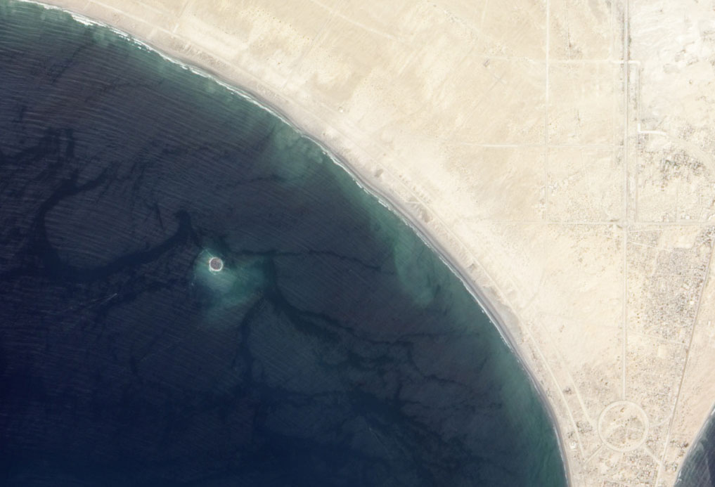
NASA’S Earth Observing-1 (EO-1) satellite captured the new island, which sits roughly one kilometre off-shore, from space on Sept. 26.
The island before and after:

The earthquake struck about 380 km inland, killing hundreds and leaving thousands homeless.
The island, a mixture of mud, fine sand and solid rock, measures 75 to 90 metres across and stands 15 to 20 metres high.
It is believed that the island is a pile of mud that was pushed up during the quake by pressurized gases. Scientists also believe that the life of the island may be short as the layer cools and settles or waves and storms wash away the loose sand and soft clay.
This isn’t the first time an island like this has been created: several of them have appeared off the 700-kilometre Makran coast over the past 100 years, however many areas are unpopulated so they may go unnoticed by residents.
Comments