

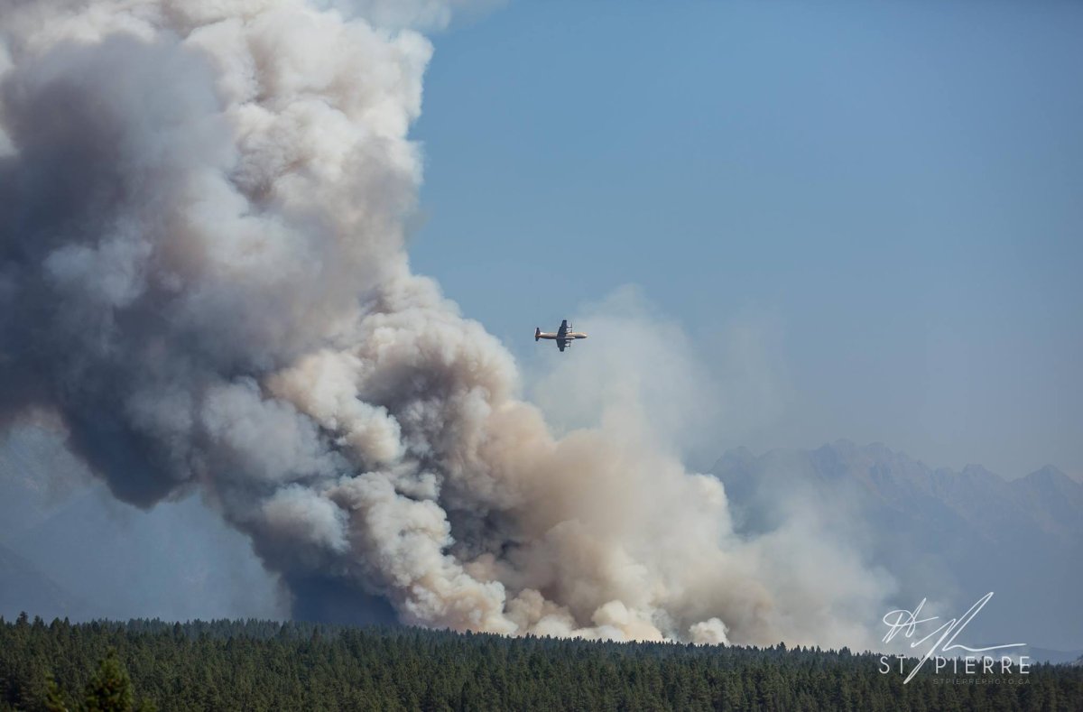
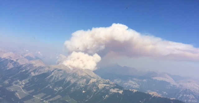
The hot, dry and windy conditions are causing wildfires in the Kootenays region to flare up and are proving a difficult fight for firefighters.

Some of the wildfires are in a difficult location, therefore the wildfire service says it is taking a modified response approach to fighting them. They are being monitored only or limited sections of the fires are being responded to when it is safe and effective for crews to do so.
MAP: Location of wildfires burning around B.C.
Here is a look at the some of the wildfires burning in the Kootenays:
Kenow Mountain wildfire
This wildfire is located about six kilometres north of the U.S. border, 71 kilometres southeast of Baynes Lake. It has now crossed the border into Alberta.
It is estimated to be 4,420 hectares and was caused by lightning. It is not currently threatening any communities and is moving in a northeast direction. Alberta Forest Service is looking to implement containment lines along the height of land to slow down the fires progression into the province.
Elder Creek wildfire
This wildfire is located on the U.S. border, approximately 64 kilometres from Baynes Lake. It is an estimated 750 hectares in size and B.C. wildfire crews are coordinating with U.S. firefighters. It is currently not threatening any communities.
The cause of this fire is under investigation.
- ‘Beast Mode’: Former Canuck Ryan Kesler back in Vancouver for Game 2 vs. Nashville
- No Demko but plenty of spirit as fans prepare for Game 2 of Canucks playoff run
- Woman shares carjack nightmare: ‘I can’t believe this is happening in Victoria’
- Caught on video: B.C. firefighter survives hit-and-run outside his own home
Lodgepole FSR wildfire
This wildfire is burning about 33 kilometres southeast of Fernie. It’s an estimated 1,751 hectares in size and was caused by lightning.
An increase in fire behaviour has made this an unsafe fire to fight at this time. It is being closely monitored and is not currently threatening any communities.
There is a forest service road closure on the Lodgepole Forest Service Road. However, at this time this area is inaccessible due to the Rocky Mountain Natural Resource District backcountry closure.
Soowa Mountain wildfire
This lightning-caused wildfire is estimated to be 530 hectares in size and burning about 20 kilometres east of Baynes Lake. It is not currently threatening any communities.
Three BC Wildfire Service personnel have worked to establish a guard for this fire as well as set up structural protection units. However, an increase in fire behaviour has made this fire unsafe for crews. The fire is being closely monitored.
Quinn Creek wildfire
This wildfire is located approximately 35 kilometres northeast of Sparwood near Top of the World Provincial Park.
It is an estimated 2,700 hectares in size and was started by lightning.
Twenty-four firefighters have set up structural protection but an increase in fire behaviour has made this fire unsafe for crews.
The fire is being closely monitored.
Linklater Creek (formally Mount Robinson)
This wildfire of note is burning 18 kilometres southwest of Newgate, which is 65 kilometres southeast of Cranbrook.
It is not threatening any structures at this time.
It is an estimated 760 hectares in size in Canada but approximately 6,100 hectares of this fire continue to burn in the USA.
Additional information on this fire can also be found here.
Fire crews say people in the area can expect to see an increase in smoke from this fire during peak temperature times and windy conditions. Smoke is highly visible from Newgate, Lake Koocanusa and surrounding areas. The U.S. Forest Service is currently fighting this fire with air support including airtankers.

Lamb Creek
The fire, estimated to be 1,400 hectare in size, is burning five kilometres northwest of Moyie and 18 kilometres southwest of Cranbrook.
It is zero per cent contained.
The Regional District of East Kootenay has issued an Evacuation Order for the Moyie Lake area. For more information call the RDEK at 250 426-2188 or visit the website.
Effective Aug. 30 there is a Forest Service Road closure for the Lamb Creek Forest Service Road starting at the 1.5-kilometre mark of the Mineral and Lamb Creek Forest Service Road to the Whitney and Irishman Creek Forest Service Road junction.
St. Mary’s River
This 398-hectare wildfire is burning 14 kilometres northeast of Cranbrook in the St. Mary’s Reserve.
It is estimated to be 76 per cent contained.
Effective Sept. 1, the Regional District of East Kootenay has issued an evacuation alert for the St. Mary River area where it meets the Kootenay River and the surrounding area. For more information on this alert call the RDEK at 250 426-2188 or visit the website.


White River Complex
This 12,000-hectare wildfire is burning about 37 kilometres northeast of Canal Flats.
The White River fire and the Grave Creek fire, which are approximately 15 kilometres apart, are now called the White River Complex.
These fires have been combined because they are near forest service roads that have restrictions in place.
These fires are not currently affecting any communities or structures.
To aid in fire suppression activities and for public safety, there is a complete road closure on the White-Schoefield Forest Service Road starting at the 78-kilometre mark, the White River Forest Service Road starting at the 32-kilometre mark and the White-East Fork Forest Service Road starting at the 60-kilometre mark.
Harrop Creek
This estimated 3,142-hectare wildfire is burning 10 kilometres south of Harrop-Procter.
It is 10 per cent contained and the north flank is fully guarded.
The Regional District of Central Kootenay has implemented an evacuation alert for the Harrop, Procter, Sunshine Bay and Kootenay Lake Village. For detailed information about this evacuation alert, people should call the Regional District of Central Kootenay at 250 352-6665 or visit the district’s website.
The Harrop Mainline and East Harrop Mainline Forest Service Road is closed to the public at this time to aid in fire suppression efforts and to keep the public safe.
Galena
This wildfire, believed to be caused by lightning, is an estimated 445 hectares in size and now estimated to be 60 per cent contained.
It is burning approximately five kilometres east of Galena Bay.
This fire is highly visible to Highway 23 and, from the Galena Bay ferry landing and surrounding area.
Crews are patrolling this fire and continuing with mop-up.

McCormick Creek
This estimated 410-hectare fire is currently burning 20 kilometres southwest of Salmo in the Pend d’Oreille area.
It is now estimated at 100 per cent contained.
Smoke may be visible from Highway 6, and the Salmo area. Expect more smoke from this fire as temperature peak in the afternoon and pockets of unused fuels burn inside the containment lines.
Comments