

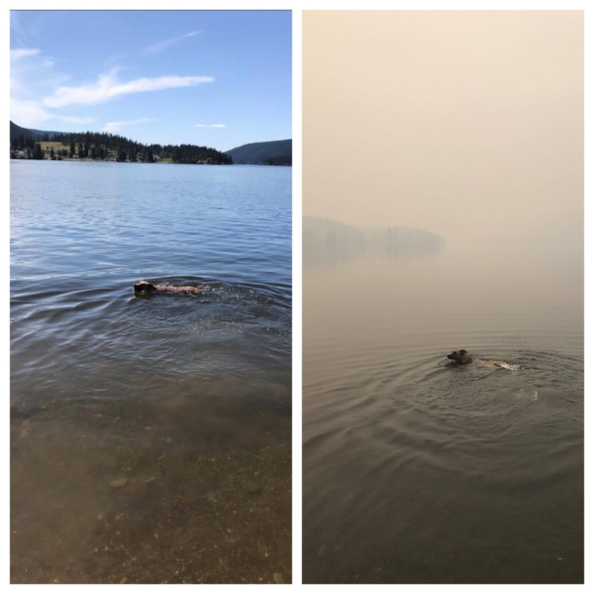
A before and after photo, taken just one week apart, shows just how quickly the air quality has deteriorated in the Williams Lake region due to the numerous wildfires burning there.

Johnny Passek shared the above photo with Global News showing his dog swimming in McLeese Lake, north of Williams Lake, just one week apart.
In the before photo, the mountains can clearly be seen in the background and the skies are blue with only a few wispy clouds in the sky.
In the after photo, the mountain in the background can barely be seen and the sky is thick with dense smoke from the fires.
The current air quality health index for the Williams Lake region is four, meaning those most at risk should consider reducing or rescheduling strenuous activities outdoors if they are experiencing symptoms.
However, the air quality is expected to reach 10 later today and into Saturday, meaning a high health risk for everyone.
FULL COVERAGE: Wildfires burning around B.C.
There are a number of large wildfires burning in this region, creating these intense smokey conditions.
A wildfire burning in the Wildwood/Williams Lake Airport area, just north of Williams Lake, remains about 12,987 hectares in size.
The White Lake wildfire, burning northwest of Williams Lake, has grown to 13,192 hectares in size.
Meanwhile, the Spokin Lake Road fire, burning about 20 kilometres east of Williams Lake, remains at 3,731 hectares in size.


A wildfire at Soda Creek, on the west side of Highway 97 — 17 kilometres northwest of the Williams Lake Airport — remains at 251 hectares in size.
Finally, the Castle Rock/Twan Lake fires have merged into one fire. It is now estimated to be 5,875 hectares in size.
MAP: Where the wildfires are burning around B.C.
Many residents in this region remain out of their homes on evacuation order.
Thousands more remain on evacuation alert and should be ready to leave at a moment’s notice.
Across B.C., about 491,782 hectares have been burned to date during this wildfire season, making it the second worse in B.C.’s history.
The worst in history was in 1958.
Comments