


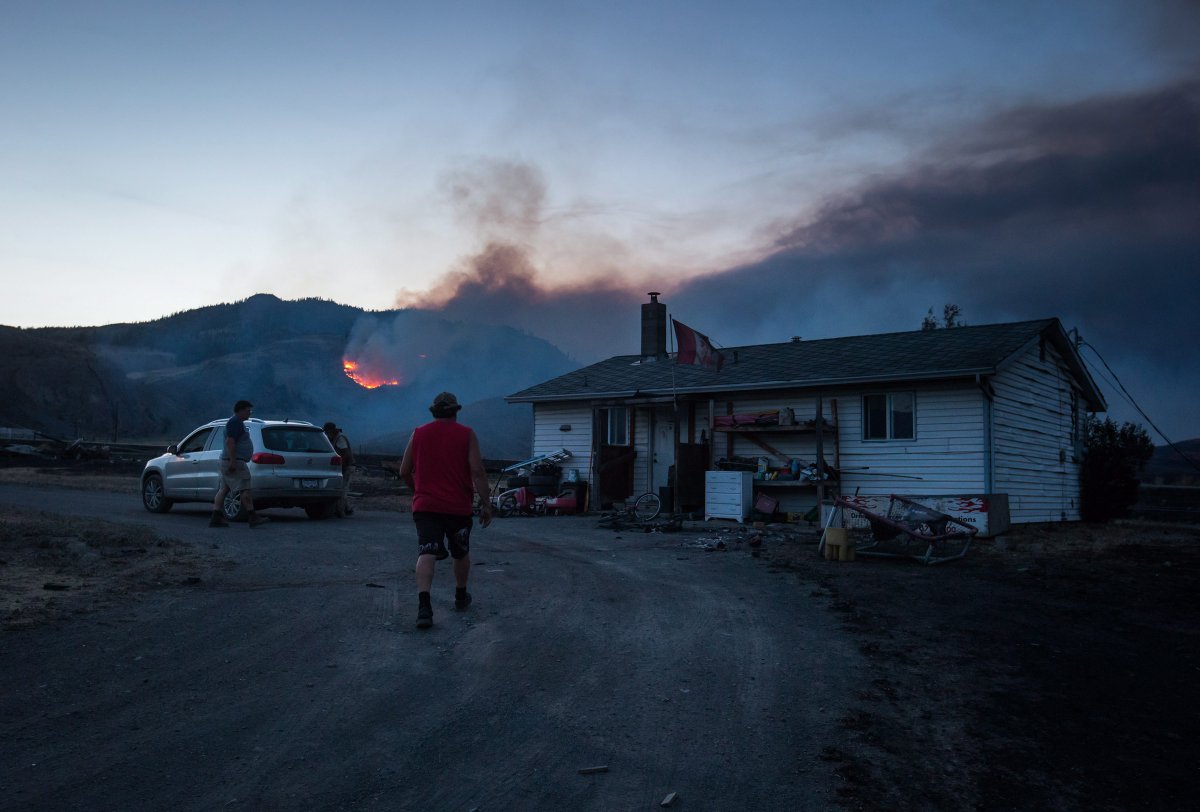
The Ashcroft wildfire has grown to 6,150 hectares and numerous evacuation orders remain in place on Tuesday.

The B.C. Wildfire Service says structures have been lost due to this fire but it has not been determined how many at this time.
One- hundred-twenty firefighters, eight helicopters, heavy equipment and support personnel are on site to fight this blaze.
FULL COVERAGE: Wildfires burning around B.C.
The wildfire has prompted the evacuation of the entire village of Cache Creek, where a local state of emergency has also been declared.
WATCH: Wildfire devastation at Boston Flats

This fire has also prompted the the Thompson-Nicola Regional District to order an evacuation of the following properties:
- 5004 Hwy 97
- 5293, 5675 – 342 Rd
- 5848 Clinton-Loon Lake FSR
- 5472, 5676, 5724, 5820, 5834, 5872, 5876, 5884, 5924, 5993 -3400 Rd
- 4864, 4980 Hwy 97
- 4880, 4896, 4904, 4908, 4920, 4936 Goble Frontage Rd
- 2180 Scottie Creek Rd
- 2156, 2161, 2185, 2188, 2191, 2205, 2257, 2258, 2300, 2305, 2392, 2393, 2397, 3195 Back Valley Rd
- 1015, 1020, 1041, 1044 Cody Rd
- 3876, 3892, 3912, 3948, 3996, 4016, 4024, 4028, 4032, 4040, 4048, 4052, 4060, 4068, 4072, 4080, 4088, 4132, 4160, 4164, 4168, 4176, 4180, 4188, 4152, 4192, 4196 Hills Frontage Rd
- 2440, 2450, 2502, 2520, 2522, 2524, 2530, 2536, 2540, 2811, 2812, 2949, 2993, 3265, 3269, 3419, 3430, 3476, 3540, 3580, 4276, 4460, 4472, Hwy 97
- 2628 Hwy 99
- 3515, 3540 Jackson Rd
- 925 Patterson Rd
- 992, 1004, 1016 Ray Rd
- 1867, 2073 Trans-Canada Hwy
- 1029, 1080, 1046, 897, 869, 1066, 1034, 1049, 992, 1022, 653, 1097, 1037 Hwy 97C
- 1201, 529, 1277, Tumble Weed Rd.
- 488, 496, 508 Empter Frontage Rd.
- 1400 Coyote Valley Rd.
- 785, 828, Airport Rd.
- 3465 Back Valley Rd
- SW ¼ of Section 35, Twp 21, Range 24, W6M
- NW ¼ of Section 35, Twp 21, Range 24, W6M
- NE ¼ of Section 35, Twp 21, Range 24, W6M
- SW ¼ of Section 2, Twp 22, Range 24, W6M
- SE ¼ of Section 2, Twp 22, Range 24, W6M
A full list of evacuation orders and alerts can be found on the Thompson-Nicola Regional District website.


READ MORE: B.C. wildfires map 2017: Current location of wildfires around the province
An evacuation alert is also in place for some addresses near Loon Lake.
Due to the potential danger to life and health, the Thompson-Nicola Regional District has issued an Evacuation Alert for the entire area around Loon Lake as identified:
- From 15 Loon Lake Rd to 3250 Loon Lake Rd
- From 3094 Stevens Rd to 3087 Stevens Rd
- 98, 125, 145, 164, 200 Cornell Rd
- 5296 Hwy 97
- 1280, 1284 Rensch Rd
- 1090, 1134, 1190 Tomlin Rd
An Evacuation Alert has also been ordered for some addresses in Electoral Area I surrounding Cache Creek.


Electoral Area “E” (10 address points):
- 4753, 4797, 5015, 5037, 5053, 5077, 5221, 5385, 5411, 5521 Hwy 97
Electoral Area “I” (46 address points):
- 3897, 3929, 3973, 3997, 4005, 4011, 4033, 4073, 4109, 4261, 4672 Hwy 97
- 3195, 3880, 3881, 4037, 4052, 4053, 4084, 4208, 4209 Old Cariboo Rd
- 4129, 4141, 4145, 4153, 4161, 4165, 4169, 4173, 4177, 4189, 4197, 4201, 4221
- Mickey Frontage Rd
- 2373, 4361, 5105, 5765, 6657, 6781, 6845, 6945 Trans-Canada Hwy
- 6141, 6228, 6288, 6511 Ashcroft Rd.
- 1468 Hwy 99
Electoral Area “J” (one address point):
- 5910 Deadman-Cache Creek Rd
Residents at those addresses should be ready to move at a moment’s notice.
Evacuees from Ashcroft and Cache Creek are going to evacuation centres in Kamloops. There they are finding supplies and support.
Production has been suspended at Norbord’s wood panel mill in 100 Mile House.
LISTEN: Jon McComb speaks to Chief Greg Blain with the Ashcroft Indian Band
Norbord says all of the mill’s employees have safely left the site, with no reported injuries, and the site was secure at the time of the evacuation.
Meanwhile, a wildfire estimated at 897 hectares is burning close to Dunn Lake, about three kilometres northeast of Little Fort, and it is zero per cent contained.
The Wildfire Service is responding to two wildfires near Dunn Lake, one to the west and one to the north. These fires are expected to run together to form one larger fire with a combined size of 1,300 hectares.
The two adjacent fires by Dunn Lake are part of a complex of three fires in the Little Fort area.
All three are currently primarily exhibiting Rank 1 and 2 fire behaviour, with some Rank 3, which ranges from smouldering ground fire to an open surface flame. At this time, there are no immediate threats to values and no structures have been destroyed.
An evacuation order is in effect due to this fire and more information can be found on the Thompson Nicola Regional District website.
Comments