
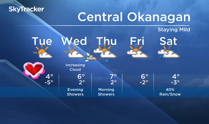
Tuesday, February 14, 2017 – Weather forecast update at 4pm:

A weather system will advance into our region Tuesday night and Wednesday with bands of precip.
Freezing levels will be between 2000m and 2500m on Wednesday. Expect a wintery mix. Some areas may see the possibility of freezing rain as many parts of the Southern Interior remains near 0C at the surface but warmer air is pushing in at the upper levels.
Sleet will also be a possibility Wednesday and Thursday morning. The precip will taper off by Thursday night.
Signs point to a break on Friday but the weekend looks unsettled with the potential for another system to track into the region from the South.


Wednesday’s daytime high range: 0 to +6
We will have the rest of your weather details coming up at 5 and 6:30 and 11pm – Hope you can join us!
~ Duane/Wesla
- Toronto Pearson gold heist: Ontario man arrested at airport after arriving from India
- Toronto’s offices are emptying out. The city wants to know what to do with them
- ‘FLiRT’ COVID-19 subvariant dominant in Canada. What to know about the strain
- Capital gains changes could have ‘irreversible’ effects, business groups warn
Comments