
WINNIPEG — Environment Canada issued a tornado watch for Brandon and surrounding areas just after 10:30 a.m. Wednesday.

In Winnipeg and other parts of the south, a severe thunderstorm watch has been issued.
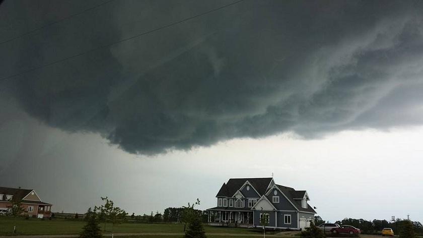
Conditions through the day will be conducive for the development of severe thunderstorms that may produce strong wind gusts, heavy rain and hail.
A system moving north from Montana will first make it’s way into southern Saskatchewan this afternoon then crossing the border into Manitoba.
The region that could be hit the hardest by the storm system is southeast Saskatchewan and then later on in the afternoon and into the evening in southwest Manitoba.
Affected by the tornado watch issued by Environment Canada:
- Brandon
- Virden – Souris
- Neepawa – Carberry – Treherne
- Melita – Boissevain – Turtle Mountain Prov. Park
- Killarney – Pilot Mound – Manitou
- Minnedosa – Riding Mountain National Park
In the event of a tornado, residents are reminded to go indoors to a room on the lowest floor, away from outside walls and windows.
Areas affected by severe thunderstorm watch:
- Winnipeg
- Selkirk – Gimli – Stonewall – Woodlands
- Portage la Prairie – Headingley – Brunkild – Carman
- Dugald – Beausejour – Grand Beach
- Morden – Winkler – Altona – Morris
- Steinbach – St. Adolphe – Emerson – Vita – Richer
- Dauphin – Russell – Roblin – Winnipegosis
- Ste. Rose – McCreary – Alonsa – Gladstone


To report severe weather you can tweet reports to #MBStorm
Expect these conditions to change throughout the day.

Comments