
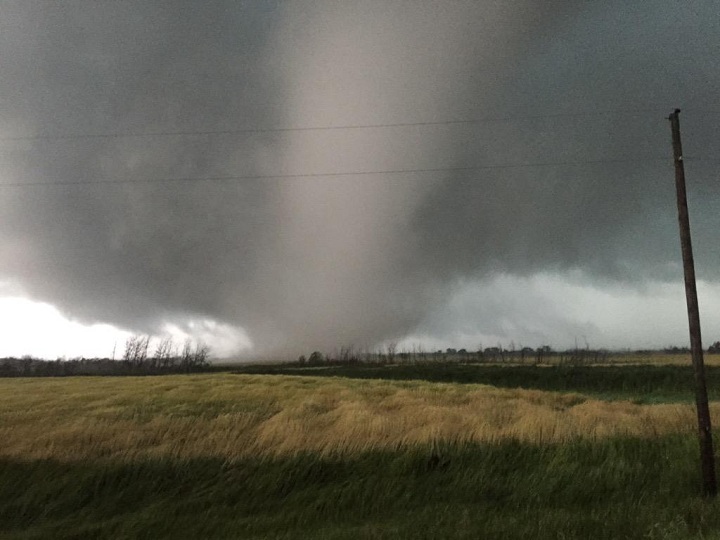
When we think of powerful, long-lived tornadoes, we tend to look to our southern neighbours. The United States is home to the most tornadoes — and some of the most powerful ever. However, on Monday night a tornado in Manitoba lasted for almost three hours, one of the longest-lasting documented tornadoes.

To get tornadoes, you first need a thunderstorm. But it’s important to note that not all thunderstorms produce tornadoes.
There are a few ingredients necessary to get a tornado: a low pressure system, humidity, sunshine, wind shear (wind that goes different directions at ground level), lift and a trigger.
Days beforehand, Environment Canada and seasoned storm chasers knew that all those ingredients were going to make for a volatile day: severe thunderstorm watches and tornado watches were issued well in advance.
And all those ingredients joined together and played out the severe weather that had been anticipated. But the duration of the tornado was a surprise.
Manitoba’s storm season has gotten off to a late start. That’s due in part to the relatively dry season that is responsible for the late crop season. In the Prairies, crops are one of the main producers of humidity (aside from the humidity that funnels up from the Gulf of Mexico).
Those conditions necessary for the generation of supercell thunderstorms — storms that have a deep rotating updraft of air — were in place on Monday. That moisture from crops and the air just helped to fuel the severe storm. Wind shear continued to feed into the storm. And it just kept on going.
“Which is pretty amazing,” said Terri Lang, an Environment Canada meteorologist.
Monday’s tornado lasted an estimated two-and-a-half to three hours, Environment Canada said Tuesday morning. But Lang stressed that this information isn’t based on just visual accounts, but radar as well. That’s because not only was the tornado rain-wrapped, but it was also dark and the tornado wasn’t visible. The radar continued to show rotation, so there is a possibility that while it was indeed rotating, it may have not have been a tornado in the sense that it wasn’t on the ground.
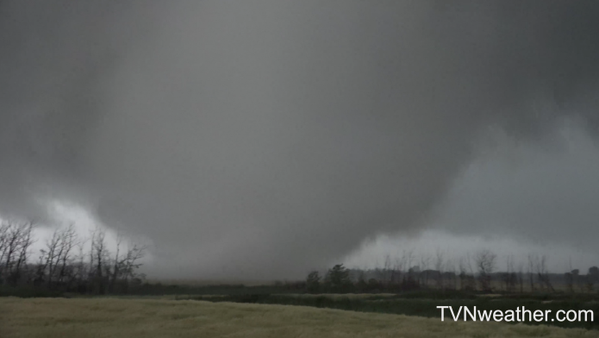
“We have a suggestion just north of Pierson in the far southwestern part of the province then it moved towards the north and it was on the ground for maybe up to three hours which is really quite amazing,” said Environment Canada meteorologist Natalie Hasell. “Normally tornadoes are on the ground for maybe just a few minutes, so the fact this was on the ground for much longer than that gives you a really good idea for how all the dynamics and thermal dynamics were lined up.”
Interestingly, though meteorologists and storm chasers were anticipating the storm for days, it fired off a bit later than expected. Around 4 p.m. the cap — a layer of warm air aloft that suppresses the development of thunderstorms — lifted. When a cap lifts, the development of severe thunderstorms can be explosive. And that’s exactly what happened Monday night.
As for the strength of the tornado, Environment Canada is sending out a team to investigate the damage in order to determine its rating on the Enhanced Fujita Scale.

Comments