
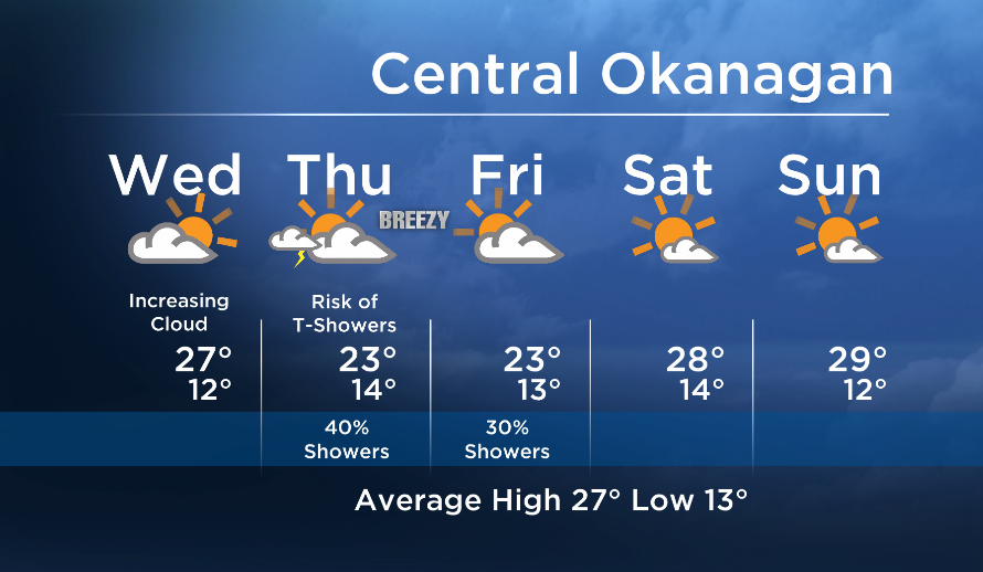
Weather update: Wednesday July 15th 5am

The next system is approaching our region from the northwest. Expect brighter conditions to start but clouds will thicken and increase for the second half of the day.
Breaking news from Canada and around the world
sent to your email, as it happens.
A cold front crossing the area tomorrow will bring the risk of showers and thundershowers. It will be breezy at times Thursday and Friday.
On Friday we will see gradual clearing, and a more stable weather pattern is in store this weekend.


Today’s daytime high range: 23 to 29C
More details coming up at 5, 6:30 and 11pm!
~ Duane/Wesla
More on Canada
Comments