
SASKATOON – Cooling happening faster than expected Friday night in Saskatoon may be a detriment to the precipitation type that falls Saturday, turning what was expected to primarily be a rain event into a heavy snowfall.

Most weather models were indicating a major precipitation event slated to hit the city Saturday would fall primary as rain, however with a cooler than anticipated atmosphere, that 30 to 40 millimetres of rain is now being projected to slam the Bridge City with snow.
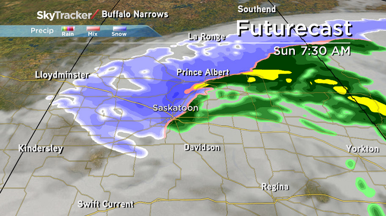
The rain snow line was previously expected to be north of the city, with areas such as Prince Albert and North Battleford expecting to see five to 10 centimetres Saturday, however that line is being shifted just south of Saskatoon.
With an above freezing ground, much of the initial snowfall will melt upon contact with the surface, however it is expected to begin accumulating midday through into Sunday morning.
Treacherous driving conditions are expected across the region as five to 10 centimetres of accumulating snow is not out of the question.


In addition to the heavy snow, winds will hold sustained speeds around 30 km/h, gusting into the 50 km/h range Saturday through Sunday reducing visibility to near zero at times as this developing area of low pressure slams through the province.
Motorists planning to head out on roads are advised to use caution and check in with Saskatchewan Highway Hotline before heading out.
For weather on the go download the Global News Skytracker weather app for iPhone, iPad or Android.
Comments