
WATCH: A savage winter storm pounded Maritimes on Sunday, causing damage, delays and dangerous driving conditions on Sunday. Global’s Ross Lord was just one of the many affected by the weather and couldn’t even get out the driveway Monday morning.
TORONTO – High winds and blowing snow are continuing to wreak havoc across the Maritimes as parts of Quebec and Ontario remained in a deep freeze Monday.

Environment Canada issued a blizzard warning for Prince Edward Island, where strong wind gusts up to 100 km/h and fresh snow will create “near zero visibilities” across the province.
Air travel has also been hampered as most flights in and out of Charlottetown Airport were cancelled Monday.
“Travel is expected to be extremely hazardous due to reduced visibility. If you do travel and become lost, remain where you are until the blizzard has passed,” Environment Canada said in a weather warning.
IN PHOTOS: Blizzard lashes New Brunswick stranding drivers

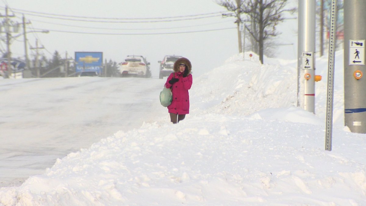


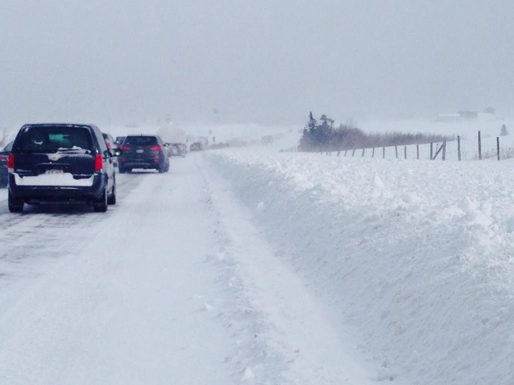

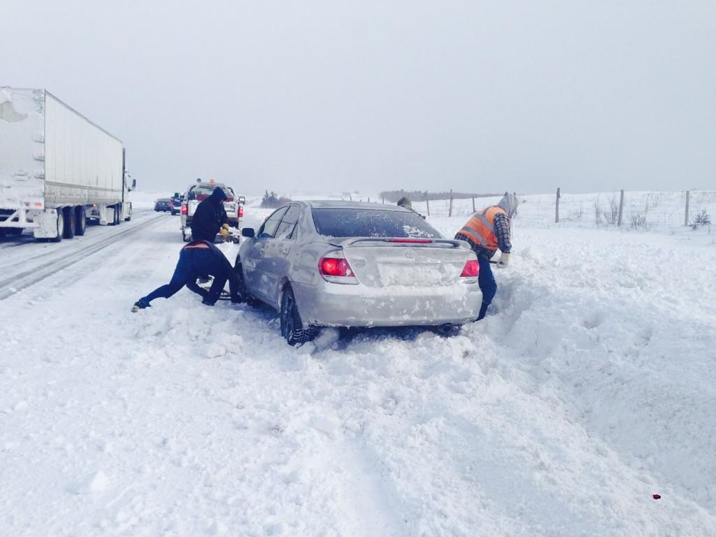


In Nova Scotia and New Brunswick, residents were digging out after snow storms dumped more than 50 centimetres in some areas that led to the closures of schools, businesses and highways.
Moncton saw the worst of the blizzard with more than 50 centimetres of snow, while Fredericton and Saint John received over 30 centimetres. New Brunswick power said almost 4,000 customers were without power Monday, while RCMP continued to ask residents to stay home while emergency crews cleared streets and rescued stranded drivers on highways.
Halifax officials are asking residents to restrict their travel so crews can clear ice and snow, as well as lay sand and gravel on roads after heavy rains were followed by freezing temperatures. On Sunday, heavy rain fell on snow that led to flooding and road closures across the city.


Nova Scotia’s transportation department is anticipating it will be at least 48 hours before some local roads in northern Nova Scotia are open to traffic again.
READ MORE: Signs, prevention and what to do if you have frostbite
Temperatures in Halifax will drop to -14 C Monday evening, with a wind chill factor of -26 C.
Blizzard warnings remained in effect for parts of Nova Scotia and Newfoundland and Labrador Monday.
The frigid Arctic temperatures gripping parts of Ontario were lifted by midday Monday, while extreme cold warnings were issued for parts of Quebec.
An extreme cold warning had been in effect for Ontario and Quebec Sunday as icy winds led to record lows for several cities including Windsor, Waterloo and Hamilton. Windchills in Toronto reached a numbing -40 C.
Environment Canada said the freezing temperatures will continue to hold in Quebec Monday and into Tuesday.
“Very cold temperatures combined with light to moderate winds will result in wind chill values of -38 to -42 in these Central Quebec regions overnight tonight through Tuesday morning,” said Environment Canada in a warning.
The weather agency also said the extreme cold will create an elevated risk of frost bite and hypothermia.
*With files from Mayya Assouad and Laura Brown
Comments