
Weather update: Monday January 5th 5:15pm

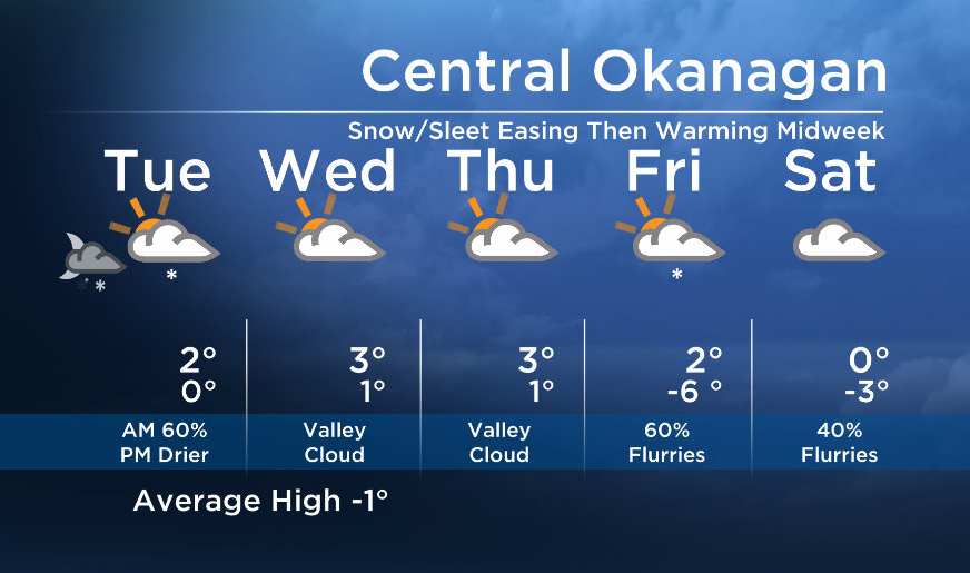
Hope you had a great weekend. “Snowmeggedon” is finally easing off for some areas… The southern regions will see a drier trend first, with the rest of region following suit Tuesday.
Breaking news from Canada and around the world
sent to your email, as it happens.
As warmer air continues to ride overtop of our valley, surface temperatures will also increase by Tuesday midday. This warmer air aloft will also cause the risk of sleet or freezing rain on Tuesday.
By Tuesday night, most areas will be dry and it will stay dry until Friday. Sunny breaks are possible Wednesday and Thursday but valley cloud is also expected. A weak system will bring a chance of flurries to the region at the end of the week.


Tuesday’s daytime high range: -1 to +4C
~Wesla/Duane
More on Canada
- RCMP arrests alleged hitmen accused of killing B.C. Sikh leader
- Fall COVID-19 vaccine guidelines are out. Here’s what NACI recommends
- Some 2019 candidates ‘appeared willing’ to engage with foreign interference: Hogue inquiry
- Thousands of Canada’s rail workers have a strike mandate. What happens now?
Comments