
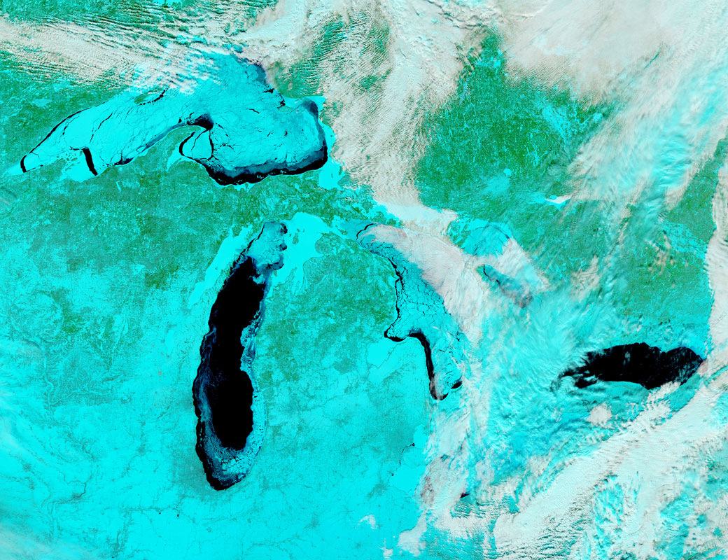
TORONTO – The Great Lakes have seen more ice cover this winter than they have in years and a NASA satellite has imaged the ice cover using infrared cameras.

According to the Great Lakes Environmental Research Laboratory, the total ice cover across the five lakes is 77.3 per cent (as of Feb. 25). The ice peaked on Feb. 12-13 with a coverage of 88.42 per cent, something that hadn’t been seen since 1994.
READ MORE: Great Lakes ice causing headaches for shipping industry
Since 1973, the Great Lakes ice coverage has exceeded 80 per cent just five times, with the highest of 94.7 per cent in 1979, a particularly harsh winter for the northern U.S. and southern Ontario.

The NASA image was taken in infrared light in order to distinguish between ice from the water, snow and clouds. The open water is the dark, blue-black colour, with thicker ice appearing lighter and melting ice as a darker blue. The clouds are the white and blue-green colours.
Comments