
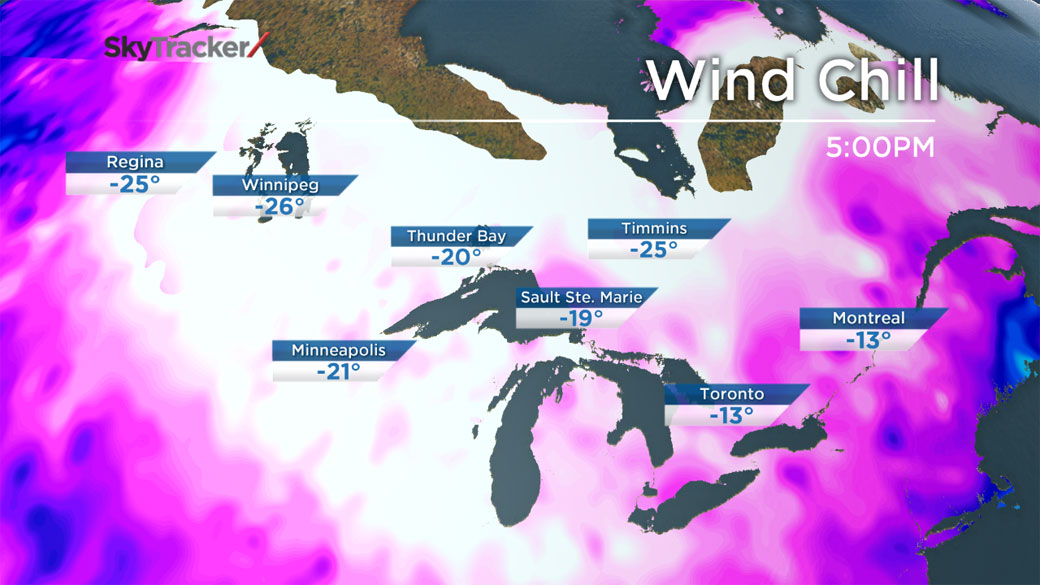
TORONTO – Once again, Saskatchewan, Manitoba and Ontario are dealing with wind chill values near -40 C.

Environment Canada has issued wind chill warnings extending from eastern Saskatchewan straight through to Ontario. Almost all of Manitoba is under the warning.
The culprit for the cold temperatures is, yes, the polar vortex.
Combined with winds near 30 km/h, the Arctic air is producing wind chills near -40 C or lower.
Temperatures in Regina and Saskatoon are expected to be below seasonal the rest of the week, with daytime highs of just -15 C or colder for both cities. The normal daytime high is around -10 C for this time of year.
READ MORE: Wind chill: how it’s measured and how it affects you
Tuesday will be the coldest day this week for those in Winnipeg, with a daytime high of -21 C. The low overnight Monday into Tuesday is forecast to be -30 C.
Northern Ontario will also have colder than usual temperatures, though not quite as cold as Winnipeg. Tuesday will also be the coldest day of the week in Ontario with temperatures around -15 C.
For those in Toronto, Ottawa, and Montreal, they get some good news: the extreme cold comes to an end by Thursday as more seasonal temperatures make what has been a rare appearance this winter.
Comments