
SASKATOON – Saskatoon’s cold kickoff to winter continues as some of the coldest air of the season moves in.

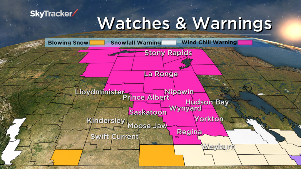
The City of Saskatoon, Regina, Prince Albert and many other part of Saskatchewan are under wind chill warnings.
Wind chills near minus 40 are expected overnight into Saturday.
Environment Canada issues wind chill warnings for southern Saskatchewan when the wind speed is forecast to be 15 km/h or greater and wind chill values of minus 40 or colder are expected to last for at least 3 hours.
Winds are expected to be stronger than 15 km/h for most the weekend with wind chills below minus 40 for most of the day Saturday and Sunday, therefore wind chill warnings can be expected right through until Monday.
With such extreme wind chill values comes the risk of hypothermia and frostbite.
Exposed skin can freeze in a matter of minutes with wind chills at or below the minimum warning criteria, so it is important to cover up completely before heading outdoors.

December 2013 is the first official month of meteorological winter and in Saskatoon, statistics are showing that the season is living up to its name.
Monthly statistics from December show that the city has kicked off the new season colder and snowier than normal.
The overall average temperature throughout December was minus 20, over 5 degrees colder than the normal average of minus 14.3.
Precipitation-wise, usually around 18.5cm of snow falls during the month, however December 2013 brought approximately 31.2cm, leaving around 17cm of accumulated snow on the ground by Dec. 31, when there is normally only 9cm snow depths reported on that date.


2014 began with some warmth moving in and temperatures eventually rising above average by Jan. 2.
While it was welcome relief for a short time, some of the coldest temperatures of the season are moving in for the weekend as arctic air invades again, slamming the mercury back down well below normal.
Temperatures are expected to eventually moderate later in the week, which will be welcome relief after a few days of what may be some of the coldest air hitting the city since January 2013.
Download the SkyTracker Weather App to stay up-to-date with the latest weather conditions, warnings and watches.
Wind chill warnings ISSUED for:
- City of Saskatoon
- City of Regina
- Martensville – Warman – Rosthern – Delisle – Wakaw
- Prince Albert – Shellbrook – Spiritwood – Duck Lake
- Melfort – Tisdale – Nipawin – Carrot River
- Martensville – Warman – Rosthern – Delisle – Wakaw
- Humboldt – Wynyard – Wadena – Lanigan – Foam Lake
- Meadow Lake – Big River – Green Lake – Pierceland
- Île à la Crosse – Buffalo Narrows – Beauval
- La Ronge – Prince Albert National Park – Narrow Hills P.P.
- Pelican Narrows – Cumberland House – Creighton
- Uranium City – Camsell Portage
- Fond-du-Lac – Stony Rapids
- La Loche – Clearwater River Provincial Park – Cluff Lake
- Cree Lake – Key Lake
- Wollaston Lake – Collins Bay
- Southend – Brabant Lake – Kinoosao
- Fort Qu’Appelle – Indian Head – Lumsden – Pilot Butte
- Yorkton – Melville – Esterhazy
- Hudson Bay – Porcupine Plain
- Kamsack – Canora – Preeceville
Comments