
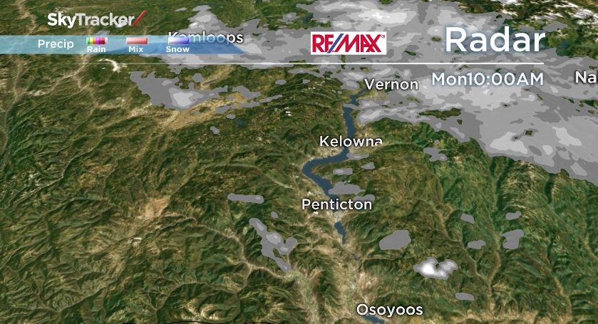
Current look at the radar shows the widespread flurries over the northern portions of the Okanagan, however just isolated pockets of flurries for the Central and the South.

A low currently over Southeast BC has bands of precip circulating around that low so we will continue to see flurries and showers on and off throughout the day.
By tomorrow the system will have moved out of our region and in the wake of it, cold arctic air will settle over the Southern Interior for the rest of the work week.
In fact many areas will start to feel the cool air moving in by this afternoon and there is a reverse temperature trend for parts of the valley as temps will fall throughout the second half of the day.

Sunshine will also accompany the cool arctic airmass starting Tuesday, however expect an increase in cloud with our dry weather starting Thursday.


Please also remember about the very snowy mountain passes today. If you can wait a day, tomorrow will be much drier for the highways.
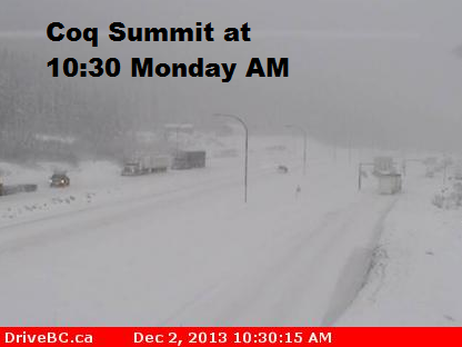
On a more positive note – our local ski hills have received between 30-50cm of snow since Friday!
Today’s Afternoon temps will fall down to between -6 to 0C
Tonight’s Low: -9 to -5C
~Duane/Wesla
Comments