
Welcome to your Friday!

Remember that inversion that we’ve been talking about over the past couple of days… well the temperature inversion is now strong enough that we are seeing valley cloud trapped in parts of the Okanagan.
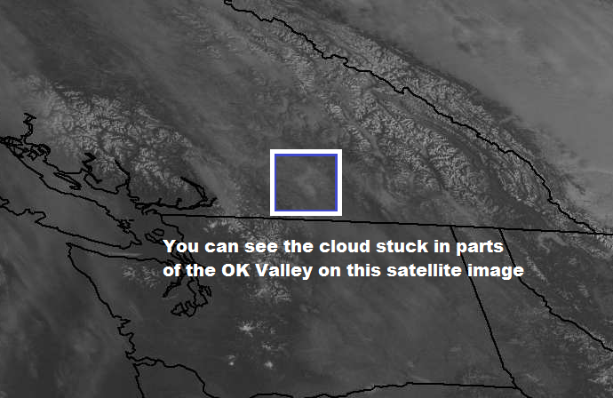
This morning at 4am the Kelowna airport weather balloon info read: -7 in the valley and -5 at about 2000m… that 2 degree difference is enough to keep fog and cloud in the forecast this morning but we are confident that this cloud/fog layer is thin enough that we will see clearing this afternoon.
Now if you are itching to get some sun this morning, the valley cloud/fog didn’t quite form in the North Okanagan or the extreme Southern portions of the valley.

Get daily National news
Also, higher terrain areas (like if you drive up to the ski hills) are above the cloud.
As we are still under this upper level weather blocking pattern, no major changes expected in temperatures except the moisture in the atmosphere will continue to increase and the inversion will get stronger.


This will lead to more valley cloud and fog this weekend.

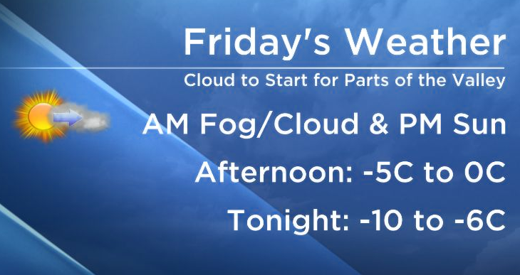
Today’s high: -5 to -1C
Tonight’s low: -10 to -7C
Enjoy your day and hope you can join us on our newscasts tonight.
~Wesla/Duane
Comments