
TORONTO – NASA scientists, together with the Italian Space Agency, have used a space-based map to generate an image of the most affected areas following Super Typhoon Haiyan.

The most heavily-damaged areas are in red.
Read more:Philippine typhoon Haiyan death toll reaches 2,275
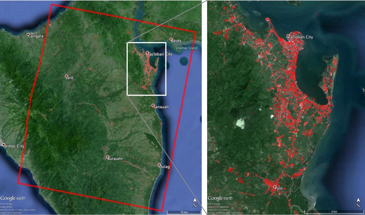
Haiyan roared through the Philippines on Nov. 8, causing widespread flooding, heavy rains and high winds. It was one of the most powerful storms ever recorded on Earth.
The image shows a 43-by-53-km-wide area near Tacloban City, which is one of the most devastated areas. Each pixel is roughly 30 metres across.
NASA’s Jet Propulsion Laboratory used an algorithm that detects changes caused by damage, be it human or natural.
NASA is hoping that the image will aid in efforts to assist those most affected by the storm.
Comments