

More snow is on the way for parts of B.C.’s South Coast Monday and Tuesday.

Environment Canada has now issued a special weather statement for Metro Vancouver, from West and North Vancouver to Surrey, Langley, Richmond and Delta.
The snow is affecting some traffic conditions. The right lanes of the Alex Fraser Bridge will be closed for the afternoon commute due to the weather.

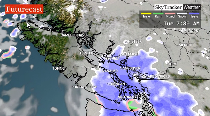
Global BC meteorologist Mark Madryga said the next weather pattern is due to a low-pressure trough slicing northwards on the South Coast.
This will bring a “slushy mix of snow and rain” for most areas Monday afternoon and evening.
“Amounts especially at higher levels of Metro Vancouver will be in the order of two to four centimetres,” Madryga said.
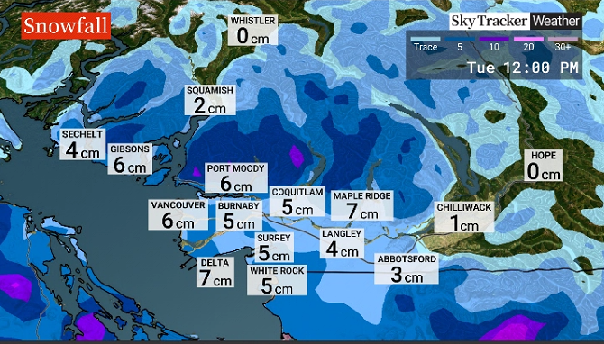
“Another band of mostly wet snow will advance into the Lower Mainland during Tuesday morning and the commute, with a further two to five centimetres of accumulation likely, again especially at higher elevations.”

Read more: Winter snowstorm batters much of B.C.
Madryga added that clearing will occur later on Tuesday and some of the snow will melt but temperatures will then drop again, meaning roads could be slick for the Wednesday morning commute.


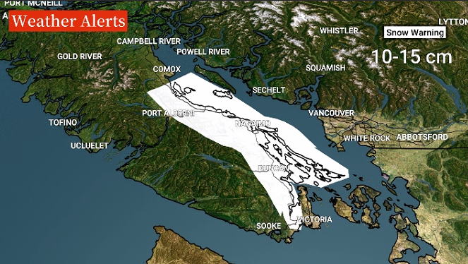
In addition, a snowfall warning is in effect for east Vancouver Island from Duncan to Nanaimo and from Nanoose Bay to Fanny Bay and for the Malahat Highway from Goldstream to Mill Bay.

Get daily National news
Between 10 to 15 centimetres of snow is expected to fall from late Monday morning to Tuesday morning.
Drivers are being urged to use caution and only travel if necessary.
The dump of snow on Sunday also broke some records for a single day of snowfall in B.C.
The Abbotsford area set a new record of 19.3 centimetres with the old record of 6.6 centimetres set back in 1956.
The Kamloops area also set a new record of 11 centimetres, with the old one of 8.4 centimetres set in 1974.
In addition, the Williams Lake area set a new record of 11.2 centimetres with the old record of 6.6 centimetres being set in 2011.
Comments
Want to discuss? Please read our Commenting Policy first.