
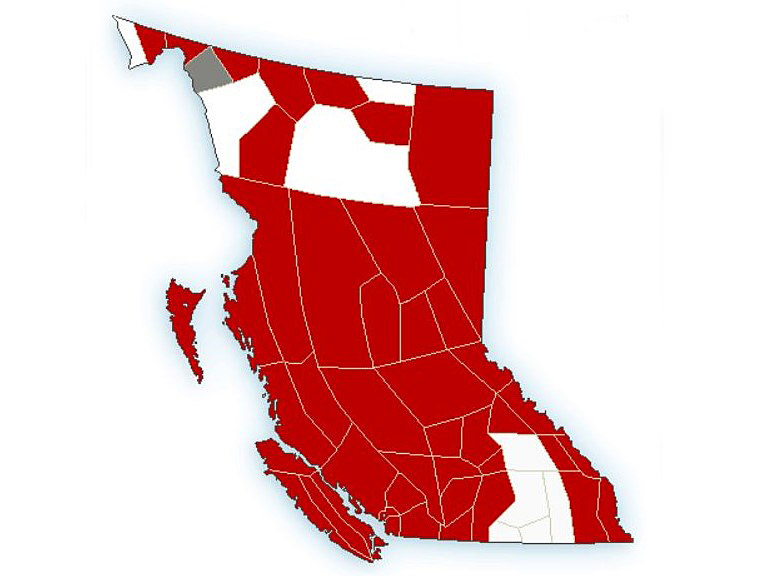
For a third consecutive day, weather warnings for extremely cold temperatures are again blanketing most of British Columbia.

Issued by Environment Canada, most of Thursday’s weather alarms are either for extreme cold warnings or arctic outflow warnings, though winter storm warnings are in effect for Metro Vancouver, Whistler, the Sunshine Coast, Howe Sound and the Southern Gulf Islands.
For those areas, the national weather agency is projecting heavy snow, followed by freezing rain, plus a wind chill of around -25.
Elsewhere, much colder temperatures are in store for Thursday, from the Yukon border to the Rocky Mountains to the U.S. border.
In the far north, which is under an extreme cold warning, Thursday’s forecast for Fort Nelson and Dease Lake has temperatures ranging from -37 C to -41 C, along with wind chill values of near -47.
However, by Saturday, Environment Canada is projecting that most of B.C. will see considerably warmer temperatures.

Below is a list of cities and towns across B.C., and the weather they’re facing for the next few days.
Far North
Arctic air has settled over the region and temperatures will remain bitterly cold through to Saturday.
DEASE LAKE
- Thursday: Mix of sun and cloud. High: -32 C. Low: -35 C. Wind chill: -38 to -48.
- Friday: Cloudy, periods of snow. High: -30 C. Low: -29 C. Wind chill: -36 to -47.
- Saturday: Cloudy, periods of snow. High: -25 C. Low: -25 C.
FORT NELSON
- Thursday: Mix of sun and cloud. High: -37 C. Low: -41 C. Wind chill: -37 to -48.
- Friday: Cloudy, periods of snow. High: -35 C. Low: -35 C. Wind chill: -41 to -47.
- Saturday: Cloudy, periods of snow. High: -30 C. Low: -31 C.
FORT ST. JOHN
- Thursday: Mainly sunny. High: -34 C. Low: -36 C. Wind chill: -33 to -50.
- Friday: Cloudy, periods of snow. High: -31 C. Low: -30 C. Wind chill: -31 to -44.
- Saturday: Cloudy, periods of snow. High: -23 C. Low: -25 C.

Central / North Coast

Get breaking National news
Threats of heavy snow and strong winds followed by 10-15 cm of snow and a risk of freezing rain are in the region’s forecast.
PRINCE RUPERT
Thursday: Mainly cloudy, followed by overnight snow. High: -5 C. Low: -8 C. Wind chill: -13 to -14.
Friday: Cloudy, periods of snow or rain. High: -1 C. Low: 0 C. Wind chill: -7 to -13.
Saturday: Cloudy, periods of rain. High: 6 C. Low: 5 C.
SANDSPIT
- Thursday: Cloudy, periods of snow. High: -1 C. Low: -1 C. Wind chill: -10 to -11.
- Friday: Cloudy, periods of snow or rain. High: 6 C. Low: 7 C.
- Saturday: Cloudy, periods of rain. High: 8 C. Low: 6 C.

Central Interior
Bitterly cold temperatures and dangerous wind chill values are in Thursday’s forecast, though things will warm up considerably during the weekend.
PRINCE GEORGE
- Thursday: Mix of sun and clouds, with overnight snow. High: -28 C. Low: -29 C. Wind chill: -25 to -34.
- Friday: Cloudy, periods of snow. High: -22 C. Low: -22 C. Wind chill: -22 to -29.
- Saturday: Cloudy, periods of snow. High: -10 C. Low: -9 C.
WILLIAMS LAKE
- Thursday: Mix of sun and clouds, with overnight snow. High: -26 C. Low: -25 C. Wind chill: -22 to -36.
- Friday: Cloudy, periods of snow. High: -16 C. Low: -20 C. Wind chill: -26 to -33.
- Saturday: Cloudy, periods of snow. High: -2 C. Low: -4 C.
Kootenays
Much like the Cariboo, unseasonably cold temperatures and dangerous wind chill values are in Thursday’s forecast, with things warming up for the weekend.
CRANBROOK
- Thursday: Mainly sunny, with overnight snow. High: -26 C. Low: -30 C. Wind chill: -31 to -37.
- Friday: Cloudy, periods of snow. High: -18 C. Low: -20 C. Wind chill: -22 to -30.
- Saturday: Cloudy, periods of snow. High: -9 C. Low: -9 C.
CRESTON
- Thursday: Mix of sun and cloud, with overnight snow. High: -15 C. Low: -16 C. Wind chill: -20 to -22.
- Friday: Cloudy, periods of snow. High: -12 C. Low: -12 C. Wind chill: -19.
- Saturday: Cloudy, periods of snow. High: -5 C. Low: -5 C.
TRAIL
- Thursday: Mainly sunny, with overnight snow. High: -15 C. Low: -15 C. Wind chill: -21 to -24.
- Friday: Cloudy, periods of snow. High: -9 C. Low: -9 C. Wind chill: -19.
- Saturday: Cloudy, periods of snow. High: -7 C. Low: -6 C.


Okanagan
Repeating the Cariboo and Kootenays, unseasonably cold temperatures and dangerous wind chill values are in Thursday’s forecast, with the weekend warming up considerably.
VERNON
- Thursday: Mix of sun and cloud, with overnight snow. High: -21 C. Low: -21 C. Wind chill: -19 to -32.
- Friday: Cloudy, periods of snow. High: -14 C. Low: -14 C. Wind chill: -24 to -30.
- Saturday: Cloudy, periods of snow. High: -6 C. Low: -8 C.
KELOWNA
- Thursday: Mix of sun and cloud, with overnight snow. High: -21 C. Low: -21 C. Wind chill: -21 to -32.
- Friday: Cloudy, periods of snow. High: -14 C. Low: -14 C. Wind chill: -17 to -24.
- Saturday: Cloudy, periods of snow. High: -6 C. Low: -8 C.
PENTICTON
- Thursday: Mix of sun and cloud, with overnight snow. High: -17 C. Low: -17 C. Wind chill: -13 to -28.
- Friday: Cloudy, periods of snow. High: -9 C. Low: -14 C. Wind chill: -21.
- Saturday: Cloudy, periods of snow. High: -6 C. Low: -8 C.

South Coast
A winter storm warning and arctic outflow warnings are in effect. Environment Canada says travel conditions will be difficult due to heavy snow, ice pellets, freezing rain or heavy rain, along with wind chill values between -20 and -30.
ABBOTSFORD
- Thursday: Mainly cloudy, with overnight snow. High: -9 C. Low: -9 C. Wind chill: -21 to -23.
- Friday: Cloudy, periods of heavy snow mixed with ice pellets. High: -5 C. Low: -5 C. Wind chill: -12 to -19.
- Saturday: Cloudy, periods of snow or rain. High: 5 C. Low: 5 C.
CHILLIWACK
- Thursday: Mainly cloudy, with overnight snow. High: -11 C. Low: -10 C. Wind chill: -20 to -22.
- Friday: Cloudy, periods of heavy snow mixed with ice pellets. High: -5 C. Low: -5 C. Wind chill: -12 to -20.
- Saturday: Cloudy, periods of snow or rain. High: 5 C. Low: 5 C.
VANCOUVER
- Thursday: Mainly cloudy, with overnight snow. High: -7 C. Low: -6 C. Wind chill: -14.
- Friday: Cloudy, periods of heavy snow mixed with ice pellets. High: 0 C. Low: 0 C. Wind chill: -6 to -11.
- Saturday: Cloudy, periods of rain. High: 8 C. Low: 7 C.

Vancouver Island
Strong outflow winds and cold wind chill values will continue before warmer temperatures arrive on Sunday.
VICTORIA
- Thursday: Cloudy, with overnight snow mixed with ice pellets. High: -4 C. Low: -4 C. Wind chill: -12.
- Friday: Cloudy, periods of ice pellets mixed with snow or rain. High: 0 C. Low: 1 C. Wind chill: -10.
- Saturday: Cloudy, periods of rain. High: 9 C. Low: 6 C.
NANAIMO
- Thursday: Cloudy, chance of flurries with overnight snow mixed with ice pellets. High: -5 C. Low: -5 C. Wind chill: -12.
- Friday: Cloudy, periods of snow mixed with ice pellets mixed. High: -2 C. Low: 1 C. Wind chill: -12.
- Saturday: Cloudy, periods of rain. High: 6 C. Low: 4 C.
CAMPBELL RIVER
- Thursday: Mainly cloudy with overnight snow mixed. High: -5 C. Low: -8 C. Wind chill: -13 to -14.
- Friday: Cloudy, periods of snow. High: -1 C. Low: 0 C. Wind chill: -7 to -13.
- Saturday: Cloudy, periods of rain. High: 6 C. Low: 5 C.

Comments
Want to discuss? Please read our Commenting Policy first.