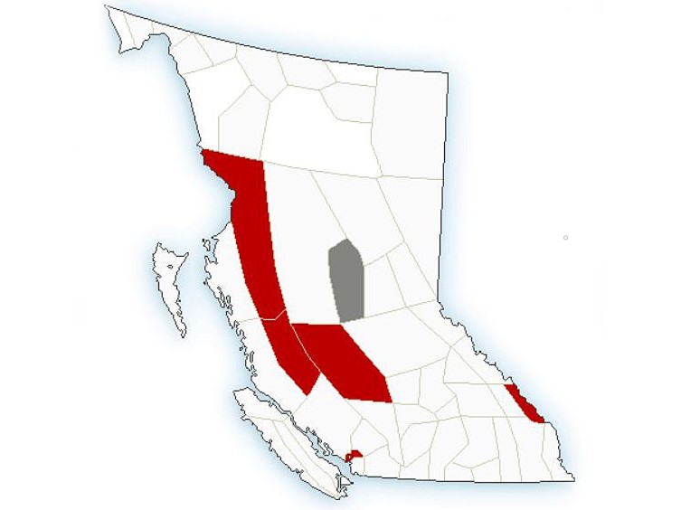
Environment Canada is warning people who live on British Columbia’s central and north coasts to dress warmly to avoid frostbite and hypothermia as frigid conditions are expected to persist this weekend.

Arctic overflow warnings are posted for the North Coast, including Kitimat and Terrace, and for the inland sections of the Central Coast.
The national weather agency says high pressure over B.C.’s Interior will continue to push arctic air out towards the coast, creating wind chill values of around -20 that are expected to persist until Monday.

Get breaking National news
It has also issued an extreme cold warning for Chilcotin near Puntzi Lake, with wind chill values around -40 expected until Sunday.
A wind warning is also in effect for Howe Sound due to northerly outflow winds of 70 km/h with the potential for gusts reaching 90 km/h.


Meanwhile, the City of Burnaby says in a news release that the return of “more seasonal weather” in the area means it will be closing the Emergency Warming Centre it opened Thursday to provide shelter for more vulnerable people during the cold snap.
The news release said it will continue to monitor the situation and reopen it if necessary.
- Here’s what we know about the Tumbler Ridge mass shooting investigation
- B.C. 2026 budget ‘neither’ big cuts nor tax increase, minister says
- Former Conservative leader John Rustad says he’s not running for his old job
- Parts of B.C.’s South Coast set to see snow-rain mix with ‘rapidly changing’ travel conditions


Comments
Want to discuss? Please read our Commenting Policy first.