Alberta was paid a visit by Jack Frost overnight resulting in extreme cold warnings throughout much of the province.

Environment and Climate Change Canada issued an extreme cold warning around 4 a.m. Friday.
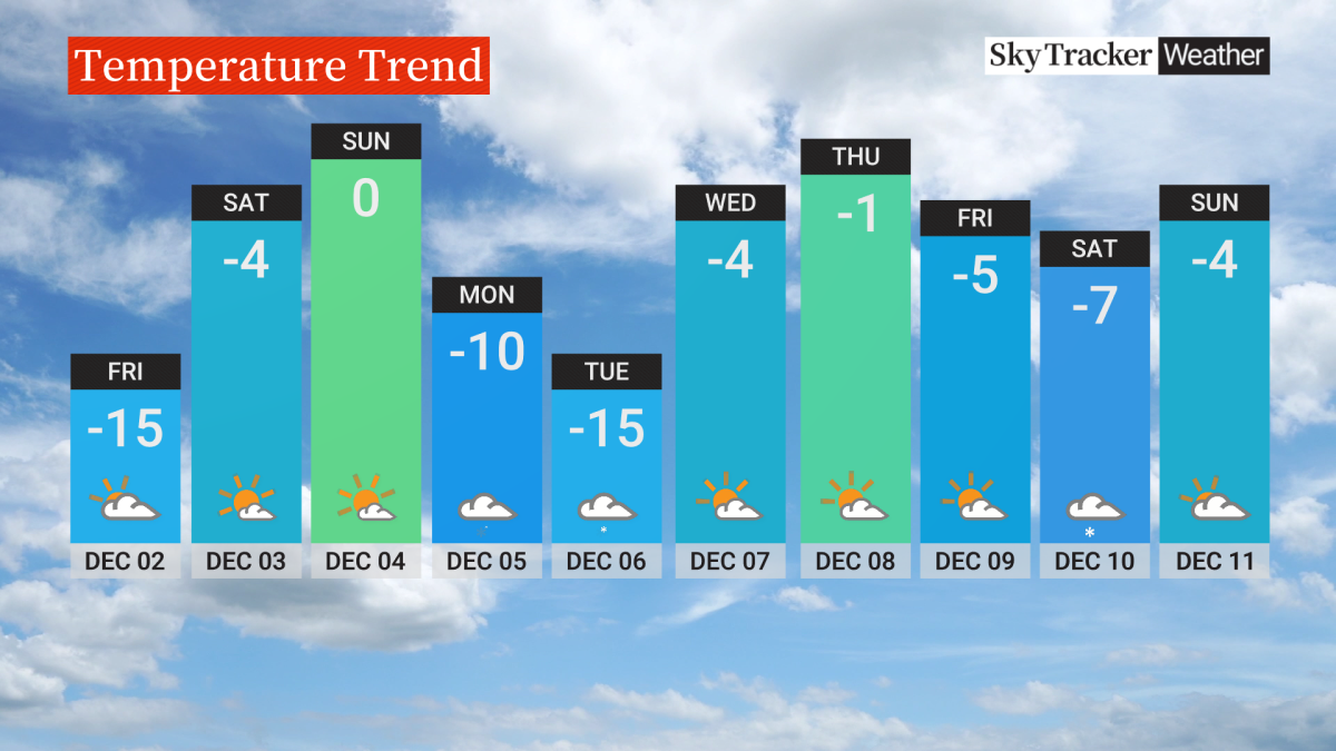
“Today will be another cold day with temperatures well below seasonal and similar to what we’ve been experiencing all week long,” said Tiffany Lizée, Global News Calgary’s chief meteorologist.
Want your weather on the go? Download Global News’ Skytracker weather app for iPhone, iPad and Android.
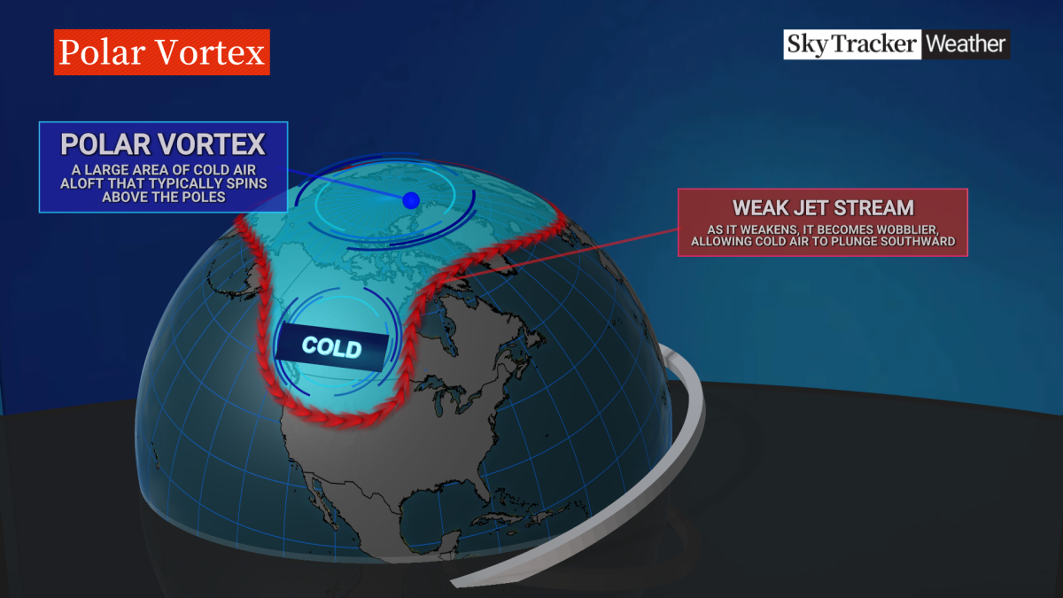
So what’s causing this spate of frigid air? Lizée attributes it to a polar vortex, which is an area of low pressure over the poles, and a trough in the jet stream that has been pushing cold arctic air down into Western Canada.
The warning covered most if not all of Alberta with some places such as Red Deer hitting -42 C in the early morning.
In a news release, ECCC said wind chill values will become moderate in the afternoon, yet extreme cold conditions could return overnight in a few regions.
“There is some relief on the way this weekend for Calgary, with more seasonal temperatures on Saturday and Sunday,” Lizée explained.
- Spring snow coming as central Alberta farmers say fields in better shape than recent years
- ‘Hopefully the last of the snow,’ as Toronto prepares for another cold snap
- Nasty Easter weekend weather leads to chaos on roads in Calgary area
- Strong winds forecast for much of B.C. starting Monday: Environment Canada
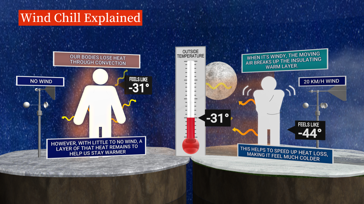
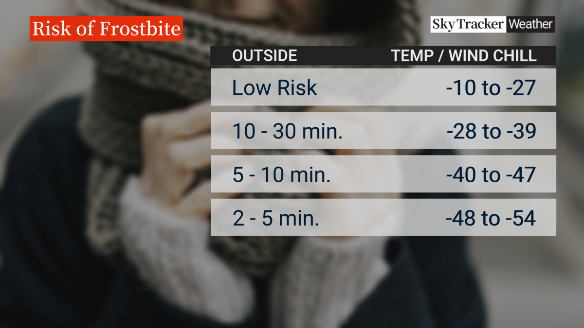
Extreme cold warnings are issued when very cold temperatures or wind chill creates an elevated risk to health such as frostbite and hypothermia.
People are advised to dress warm by layering up, and to remove various layers if they get too warm. The agency said the the outer layer should be wind resistant to combat the wind chill.
ECCC said health risks are greater for young children, older adults, people with chronic illnesses, people working or exercising outdoors and those without proper shelter.






Comments
Want to discuss? Please read our Commenting Policy first.