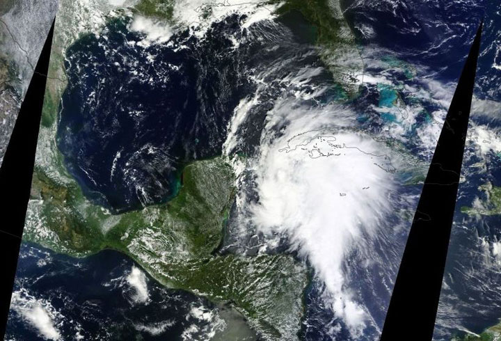
TORONTO – Just as Tropical Storm Jerry was downgraded to a tropical depression, Tropical Storm Karen formed in the Gulf of Mexico Thursday morning.

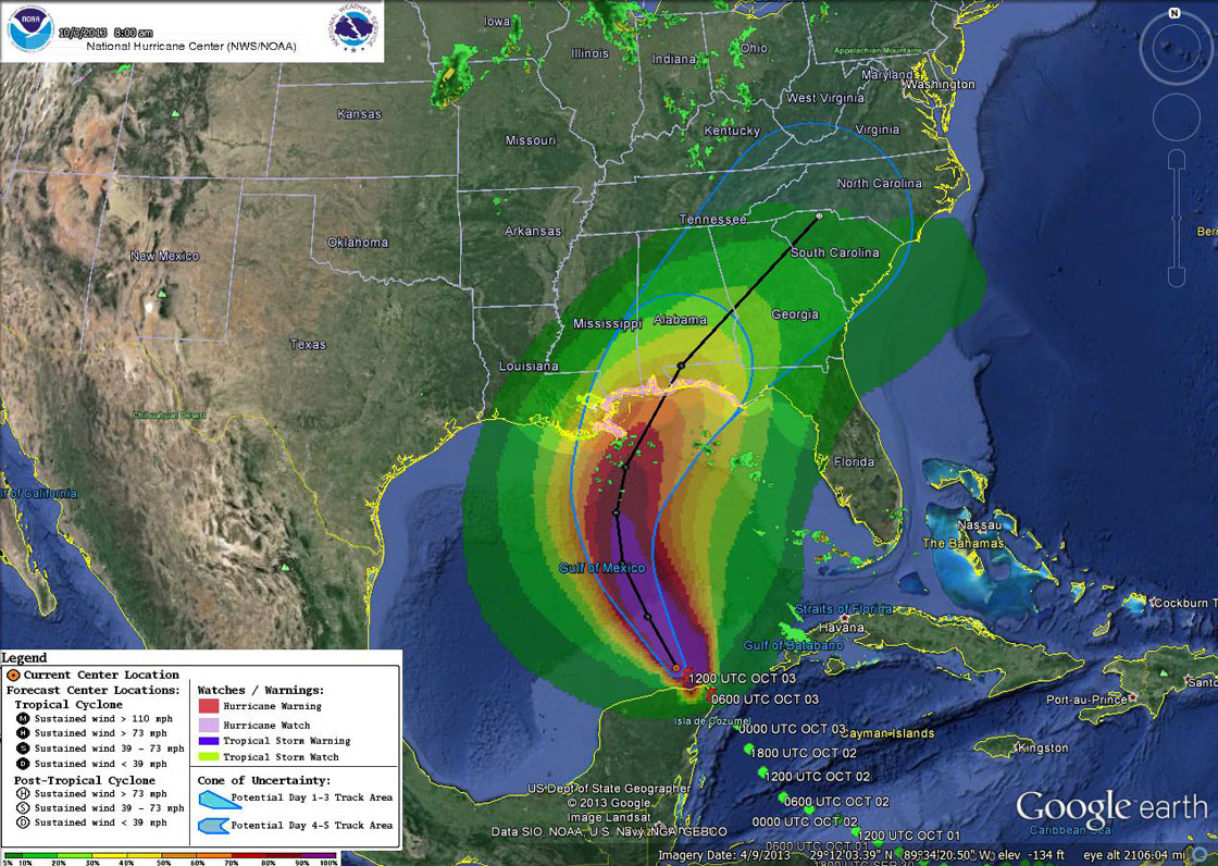
A hurricane watch – meaning that hurricane conditions are possible – is in effect for Grand Isle, La. to Indian Pass, Fla.
According to the National Hurricane Center (NHC), which is still operating despite the recent U.S. government shutdown, the watch is usually issued “48 hours before the anticipated first occurrence of tropical-storm force winds.”
In other parts of Louisiana, a tropical storm watch has been issued.
The current forecast has Karen increasing to a hurricane by mid-Friday, but making landfall in the United States as a tropical storm on Saturday.

Get daily National news
Karen is moving north-northwestward near 19 km/h but is expected to turn north and slow down within the next 48 hours. Winds of 100 km/h have been reported from an Air Force Reserve Hurricane Hunter aircraft, but some strengthening is possible within the next day or so.
People planning to travel to the affected areas, should be sure to check the NHC site for updates.
Meanwhile Tropical Depression Jerry continues to move northeastward at 19 km/h. It will likely impact the Azores on Saturday morning.


Comments
Want to discuss? Please read our Commenting Policy first.