
After a snowy start to the week, precipitation tapers off Monday afternoon as temperatures climb to just shy of the freezing mark.

Another wave of clouds rolls in Monday night with pockets of light flurries possible at times on Tuesday.

The mercury will slide back to around -6 C Monday night before rebounding to around -1 C Tuesday afternoon.
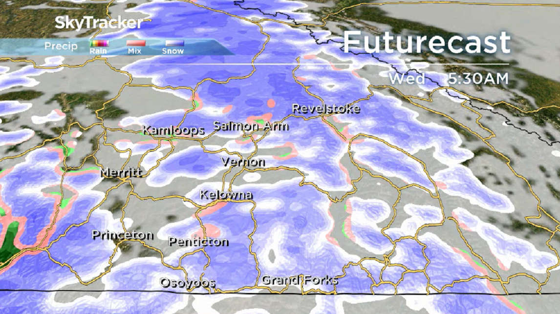
Pockets of more moderate snow and rain are expected on Wednesday with a daytime high jumping just above the freezing mark.

Get breaking National news
Mostly cloudy skies return to finish the first full week of December with afternoon highs around the freezing mark.


The risk of more mixed precipitation returns over the weekend with daytime highs just above freezing.

For weather on the go download the Global News SkyTracker Weather App for iPhone, iPad or Android.
- ‘Alarming trend’ of more international students claiming asylum: minister
- TD Bank moves to seize home of Russian-Canadian jailed for smuggling tech to Kremlin
- Justin Trudeau headed to UN Summit of the Future amid international instability
- Canadian government’s satellite deal has Tories calling for Elon Musk involvement


Comments