


Severe thunderstorms started Friday afternoon and more are expected to last into the evening hours and potentially beyond.

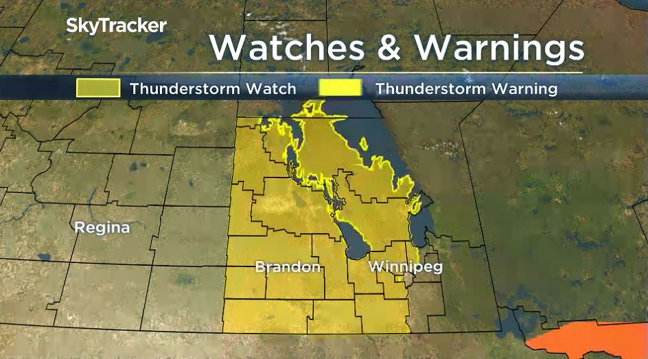
Environment and Climate Change Canada first issued severe thunderstorm watches for most of southern Manitoba and into the Interlake region at 11:10 A.M.
Severe storms began near noon around the southern end of Lake Manitoba and with southern Manitoba expecting daytime highs near 30 degrees Celsius and humidex values approaching the mid-30s, there will be plenty of heat and moisture available to fuel storm activity.
Coming into the day, severe thunderstorm activity was likely.

Large hail (2-6 cm), damaging winds (90-100 km/h), and heavy downpours (50 mm) are all threats in severe storms on Friday.

Get breaking National news
There is also a risk of tornado activity around southwestern Manitoba.
Severe thunderstorms will continue through Friday afternoon and will continue to move East through the late afternoon and evening hours. Storm activity will likely be quite scattered, in small clusters. As the storm moves, thunderstorm watches and warnings will be updated by Environment and Climate Change Canada.


Severe weather is also likely south of the border.

In North Dakota and in Minnesota, there will likely be severe thunderstorm activity and possible tornado activity as well.
Winnipeg has a moderate risk of seeing severe thunderstorm activity. Timing of the storms arriving near the city and around the Red River Valley look to be closer to the evening hours (after 6 p.m.).
Thunderstorms could last through the evening, as the focus will shift away from the southwest, and stay around southeastern Manitoba. Storm could start to diminish after midnight.
Comments
Want to discuss? Please read our Commenting Policy first.