
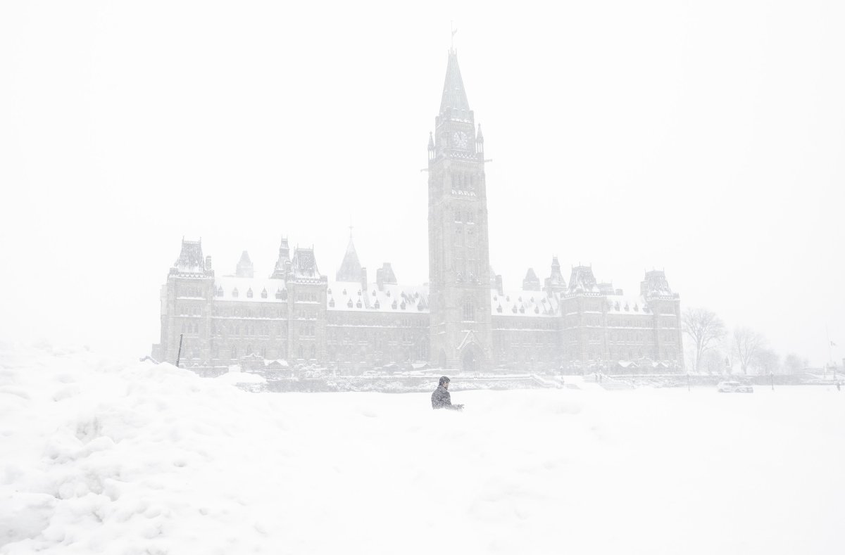
Ottawa might get battered with up to 40 centimetres of snow by Thursday after a winter storm moves in Wednesday, Environment Canada says.

The weather agency on Tuesday afternoon upgraded a winter storm watch to a winter storm warning for the national capital and a few surrounding areas.

Light snow is expected to start falling early Wednesday and turn heavy in the afternoon, Environment Canada forecasts. The snowfall will continue through the night before easing to flurries late Thursday.
Snowfall amounts higher than 40 centimetres are possible in some areas, especially near the Quebec border, the agency says.

Get daily National news
Environment Canada recommends avoiding non-essential travel if possible. Commuters should prepare for “poor winter driving conditions” and low visibility during the heavy snowfall, the winter storm warning says.
- Michael Kovrig reflects on ‘brutally hard’ Chinese detention: ‘You’re totally alone’
- U.S. moves to ban Chinese software, hardware from all vehicles in America
- After controversial directive, Quebec now says anglophones have right to English health services
- Something’s fishy: 1 in 5 seafood products are mislabelled, study finds


Identical winter storm warnings for Wednesday are also in effect for Prescott and Russell, east of Ottawa, and the following areas west of the national capital:
- Barry’s Bay – Killaloe
- Petawawa – Pembroke – Cobden
- Renfrew – Arnprior – Calabogie
Meanwhile, a snowfall warning is now in place for the Cornwall area, forecasting 15 to 25 centimetres of snow by Thursday afternoon.
Environment Canada said earlier Tuesday that a low pressure system moving into eastern Ontario from the central United States is responsible for the expected snowfall.


During the snowfall on Wednesday, temperatures in Ottawa will reach a high of -1 C, with the wind chill making it feel more like -7 C in the morning. The evening will bring temperatures near zero and a risk of freezing rain, according to Environment Canada.
On Thursday, amidst periods of heavy snow and “local blowing snow” in the afternoon, the agency predicts a high of -4 C in the afternoon, with the wind chill making it feel like -13 C. The low at night will be -11 C.
Temperatures in Ottawa are expected to remain below zero going into the weekend.

Comments