
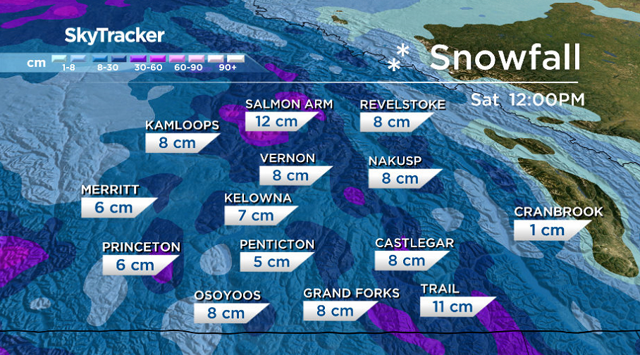
After 10 to 30 centimetres of snow fell in the Okanagan earlier in the week, another wave is on the way to finish the first full week of 2020.

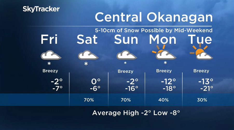
Thursday started off on a cool note with temperatures down to -13 with wind chills as cool as -17 in Kelowna before the mercury starts to climb back toward the freezing mark in the afternoon.

Get daily National news
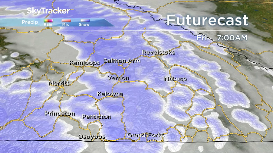
The next frontal system will roll in by Friday morning, spreading 5 to 10 centimetres of snow across the valley bottom with a gusty southerly wind bringing reduced visibility at times.
Temperatures will stay below freezing all day, a trend that will dominate through to the end of the month.
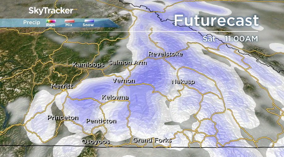
Lingering light snow is expected over the weekend with an additional 5 to 10 centimetres possible before the mercury makes a nose dive into the mid-minus teens Sunday night.


Daytime highs will drop into minus double digits for the second full week of the year with overnight lows possibly pushing into the -20s as partly-to-mostly cloudy conditions prevail with a chance of flurries at times.
For weather on the go download the Global News SkyTracker Weather App for iPhone, iPad or Android.
- After controversial directive, Quebec now says anglophones have right to English health services
- Home reno spending was up $300B over pandemic, Re/Max Canada says
- Michael Kovrig reflects on ‘brutally hard’ Chinese detention: ‘You’re totally alone’
- U.S. moves to ban Chinese software, hardware from all vehicles in America


Comments