

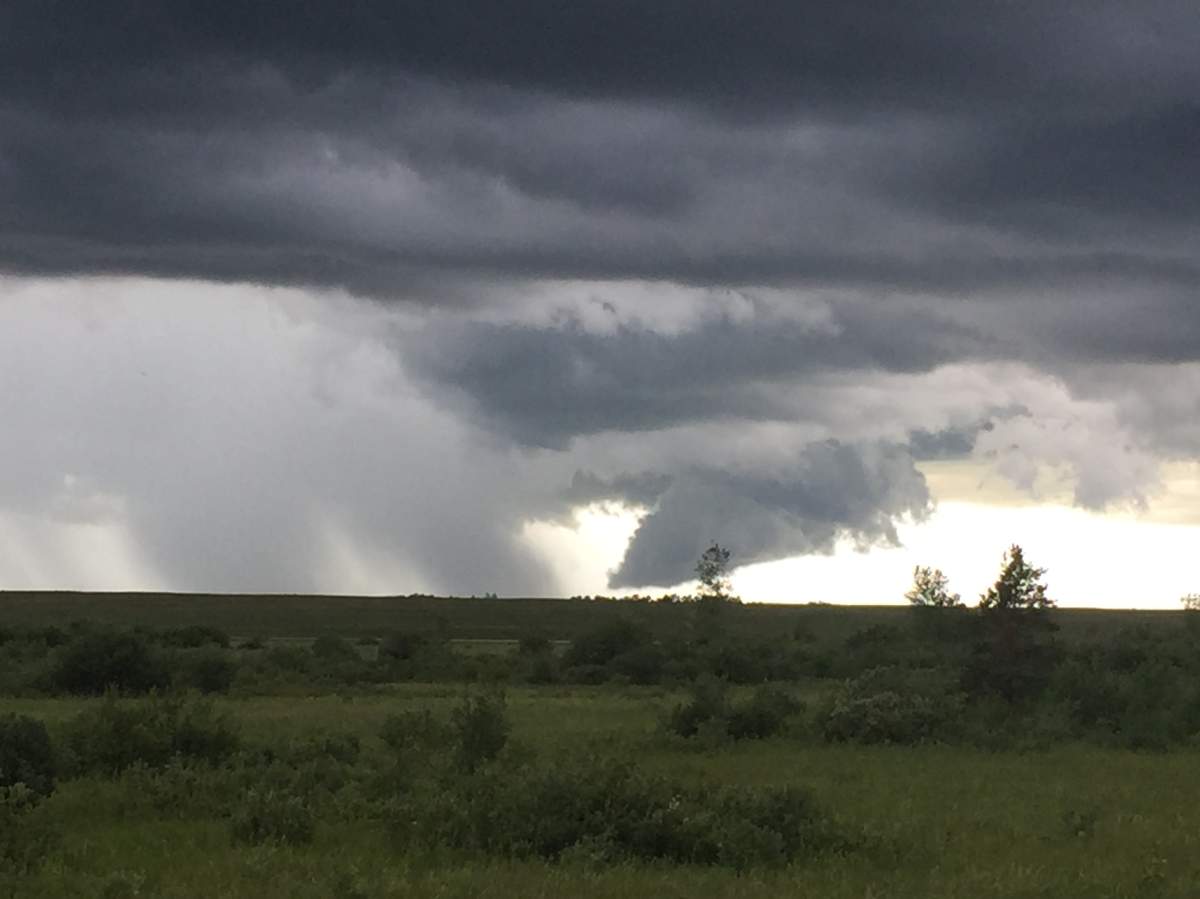
Thunderstorm activity started Saturday afternoon in southern Manitoba and is expected to continue well into the night.

While there was also thunderstorm activity in southern Manitoba Saturday morning, these storms have the potential to produce tornado activity.
The thunderstorm outlook from Environment and Climate Change Canada, issued Saturday morning, has the risk of severe weather as ‘extreme’.

Severe thunderstorm watches were issued for southwestern Manitoba early Saturday afternoon with the first severe thunderstorm warnings issued in southwestern Manitoba for Dauphin, Russell, Roblin, Winnipegosis, Ste Rose, McCreary, Alonsa and Gladstone near 3:30 P.M.
WATCH: (June 22, 2018) What to do in case of a tornado

Severe weather was already reported in Saskatchewan with golf ball-sized hail near Estevan and loonie-sized hail near Weyburn.
Storm activity will persist around southwestern Manitoba through the afternoon and into the evening hour, and according to Environment and Climate Change Canada, this is the area that is at the greatest risk of seeing tornado activity.
- Old Man Winter wallops B.C.’s Mainland/Southwest region, major highway closed
- Calgary hit by unexpected blast of spring snow, causing dozens of crashes
- False spring strikes again: Saskatchewan prepares for incoming winter weather
- Albertans’ interest in alternative forms of travel growing as fuel prices spike


Environment and Climate Change Canada says the storms Saturday afternoon and Saturday night have the potential to also produce large hail (3-5 cm), heavy downpours (50-75 mm) and damaging wind gusts (90-120 km/h).

Get breaking National news
While tornado activity and large hail cannot be ruled out as the storms continue into the evening and overnight hours, they are more likely to occur Saturday afternoon and possibly the early evening.
As the day progresses, the storm is expected to form a line and while severe weather will still be possible, it becomes less likely that hail and tornado activity will take place. Damaging wind gusts and heavy downpours will still be possible.
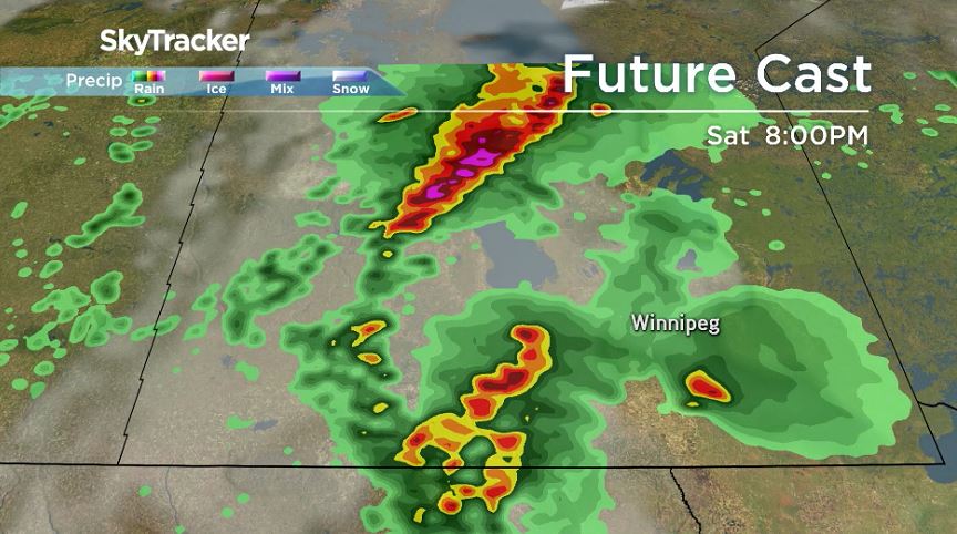
Storms are expected to move through southern Manitoba fairly slow and could arrive near Portage la Prairie close to 9 p.m. and Winnipeg closer to 11 p.m.
Comments
Want to discuss? Please read our Commenting Policy first.