
Temperatures soared into the 30s for the first weekend of June after the fourth-driest May ever recorded and the driest meteorological spring (April, May and June) on record in Kelowna.

After dipping back to 17 degrees to start the first week of the new month, sunshine got back into full swing during the day with the mercury sliding back into the 20s heading into the noon hour.
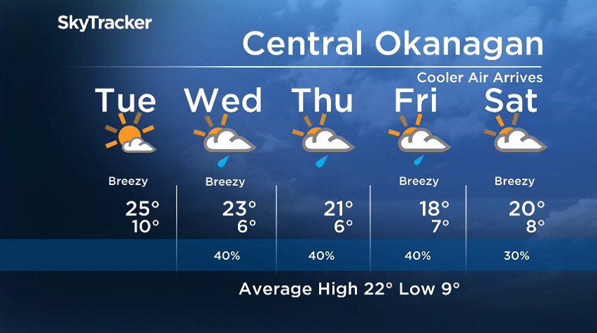
Mostly sunny skies linger through Monday afternoon as the valley warms back into the mid-20s.

Get daily National news
Sunshine sticks around for most of the day on Tuesday as temperatures return to around 25 degrees in the afternoon before clouds and cooler air drops in with an upper trough during the evening.
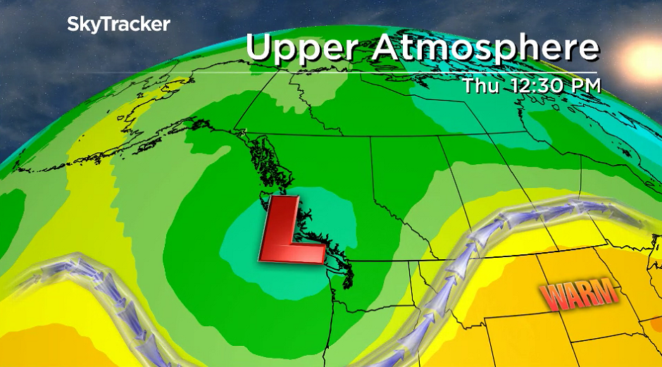
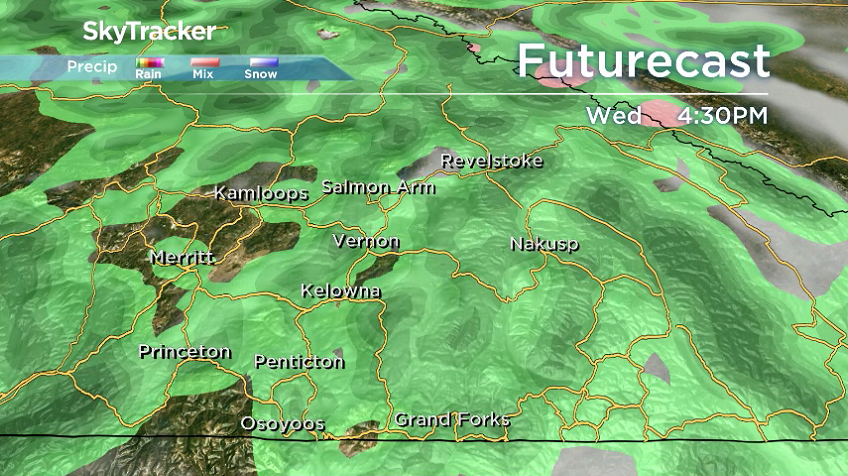
That trough will destabilize the atmosphere and bring in a chance of showers and risk of a thunderstorm Wednesday and Thursday as afternoon highs sink back into low double digits.


An upper low dives in on Friday and brings in the coolest day in a while with a good chance of showers and daytime highs back in the high teens.
Clouds, cool conditions and the chance of spotty showers continue into the weekend as daytime highs gradually climb back into the low 20s.
For weather on the go download the Global News SkyTracker Weather App for iPhone, iPad or Android.
- ‘Alarming trend’ of more international students claiming asylum: minister
- Justin Trudeau headed to UN Summit of the Future amid international instability
- Canadian government’s satellite deal has Tories calling for Elon Musk involvement
- TD Bank moves to seize home of Russian-Canadian jailed for smuggling tech to Kremlin


Comments