
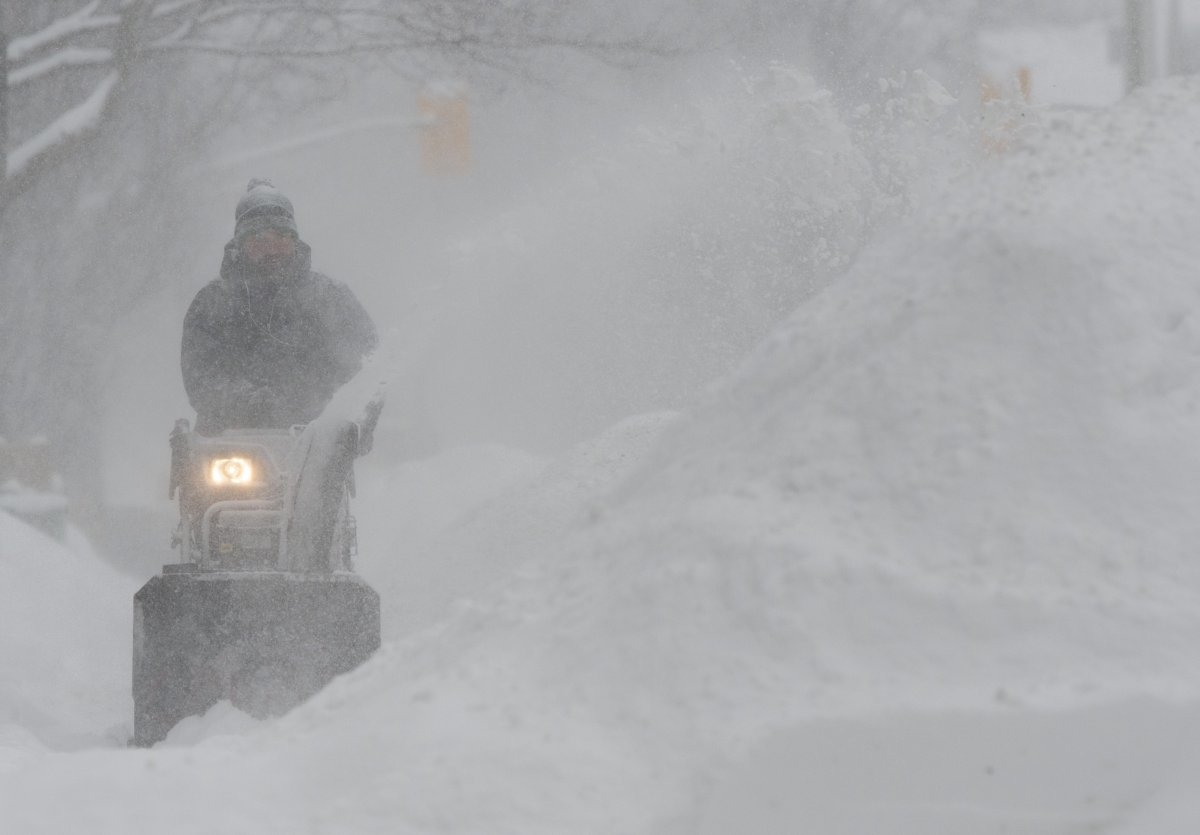
A Colorado low crossing southern Ontario on Tuesday and Wednesday is expected to unload 30 to 40 centimetres of snow on the city of Ottawa over those two days, according to Environment Canada.

The national weather agency has issued a winter storm warning for the national capital. The warning also advises of winds gusting up to 60 kilometres per hour that “may cause near zero visibility in blowing snow.”
The heavy snowfall is expected to begin around midday on Tuesday and die down on Wednesday afternoon.
Environment Canada recommends Ottawa residents and commuters postpone “non-essential travel” until weather conditions improve.
“Rapidly accumulating snow will make travel difficult,” the agency says. “If visibility is reduced while driving, slow down, watch for tail lights ahead and be prepared to stop.”
“If you must travel, keep others informed of your schedule and destination and carry an emergency kit and mobile phone.”
The storm could also cause localized power outages, Environment Canada added.
Ahead of the significant snowfall expected to begin Tuesday, municipal road crews are “preparing to plow and salt roads and sidewalks,” the City of Ottawa said in a statement on Monday afternoon.
- RCMP arrests alleged hitmen accused of killing B.C. Sikh leader
- Fall COVID-19 vaccine guidelines are out. Here’s what NACI recommends
- Some 2019 candidates ‘appeared willing’ to engage with foreign interference: Hogue inquiry
- Thousands of Canada’s rail workers have a strike mandate. What happens now?
“Residents are asked to exercise caution if driving, cycling or walking and to allow extra time for their commutes,” the statement said. “Drivers are also reminded to be patient and keep a safe distance behind working snow plows.”
The city is also asking drivers to refrain from parking on the street during the snowfall, if possible, to facilitate snow removal operations.


On Tuesday, Environment Canada predicts, the high will reach -11 C, with a wind chill of -28 in the morning, -22 in the afternoon and -13 overnight.
Ottawa’s public health agency extended its frostbite advisory from last weekend into Tuesday morning.
Wednesday is expected to be warmer, with a high of -3 C and a low of -13.
Ottawa’s single, largest dump of snow so far this winter was a total of 25 centimetres on Wednesday, Jan. 23, according to Environment Canada’s records.

Comments