

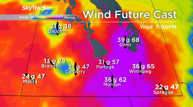
Light snow and very strong winds are in the forecast Wednesday for southern Manitoba.

Snow was already falling around much of Manitoba Wednesday morning. At the high end, parts of the northern Interlake or the north basin could see around 5 cm but around most of the south, snowfall totals will be closer to 2 cm.

While snow will be light, winds will be strong.
As low pressure moves away and high pressure settles over Manitoba, very strong winds are likely. Gusts around southern Manitoba will likely reach 60 or 70 km/h late Wednesday afternoon and Wednesday evening and reduce visibility on the roads due to blowing snow.
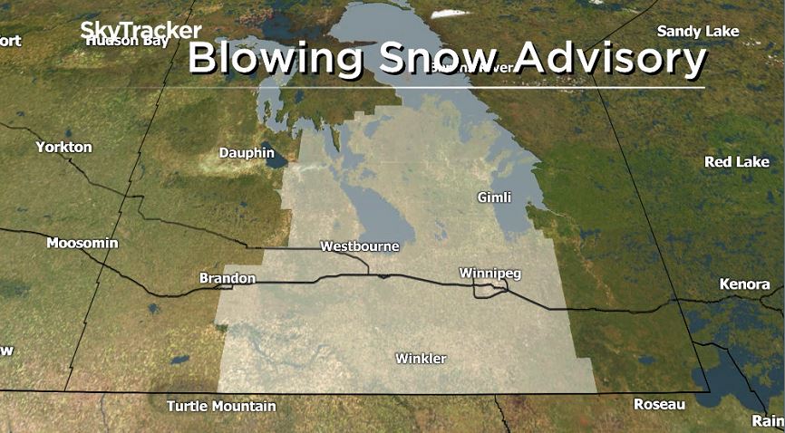
A blowing snow advisory was put in place by Environment and Climate Change Canada early Wednesday morning. For Winnipeg, blowing snow will likely be more of a factor towards the evening hours.


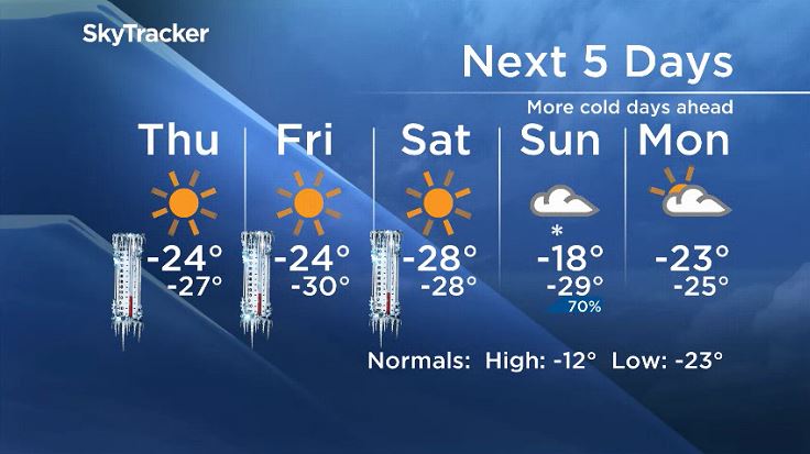
By Thursday morning, winds will be calmer but the temperatures will be bitterly cold.
Extreme Cold Warnings were first issued for northern Manitoba Tuesday afternoon — these will slowly be expanded southwards and could reach Winnipeg and the Red River Valley with the wind chill expected to dip below -40 late Wednesday night and into Thursday morning.

Get daily National news
Temperatures are expected to stay cold through at least Friday before starting to ease very slowly over the weekend.
WATCH: From igloo dinners to winter zip lines, here’s five ways to embrace winter in Canada

Comments
Want to discuss? Please read our Commenting Policy first.