Ten degrees below zero is what it felt like early Monday as temperatures dipped back to -6 degrees before hopping up to around -2 by daybreak.

After a cloudy start to the day, some sunny breaks began to be noticed by mid-morning, and continued to appear in increasing fashion through the day with the mercury rising above freezing for a daytime high.
Clear skies will linger into the evening, allowing conditions to cool down to around -5 degrees with wind chills back in minus double digits.

Get breaking National news
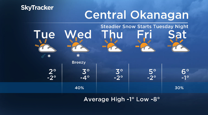
The fairly calm conditions get disturbed Monday night by a frontal system sweeping through, building back in the clouds overnight with snow likely by Tuesday morning as temperatures warm to around -3.
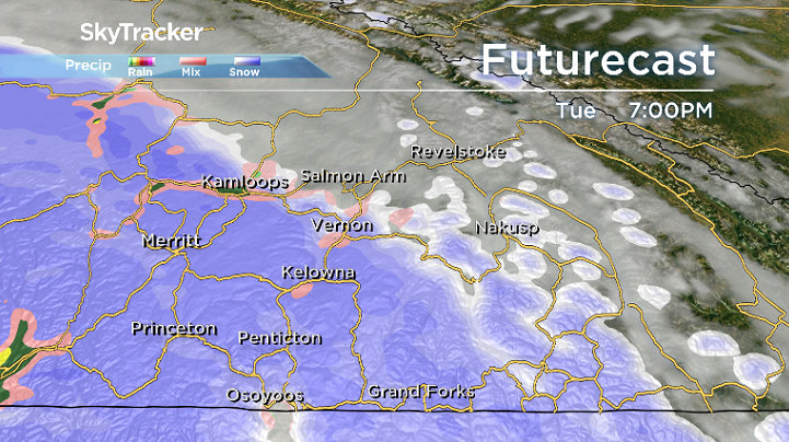
Light snow eases during the morning with some early afternoon sunny breaks possible with a daytime high a few degrees above freezing before the next round of snow pushes in later in the day with a chance of rain on the leading edge of the precipitation.
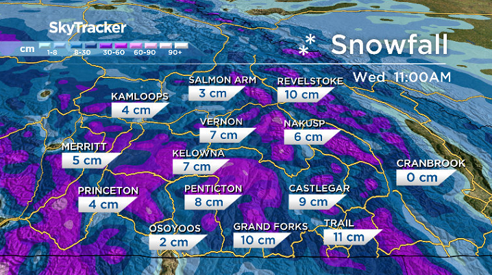
Tuesday night’s snowfall is expected to continue into Wednesday morning before switching over to some light rain and easing during the day as sunshine returns by the afternoon.
Possibly upwards of 5 to 7 centimetres of snow could fall in the valley bottom by the time precipitation begins to ease during the morning with an afternoon high climbing back a few degrees above freezing.

Partly cloudy conditions will then re-establish themselves throughout the region to finish off the week with morning valley cloud possible under an inversion and upper ridge into the weekend.
Daytime highs are expected to recover into mid-single digits with morning lows a few degrees below freezing right through the weekend.
For weather on the go download the Global News SkyTracker Weather App for iPhone, iPad or Android.


Comments