

UPDATE: All thunderstorm watches mentioned in this story have ended.

Monday’s 30 degree heat slides out to make way for a cooler final day of July.
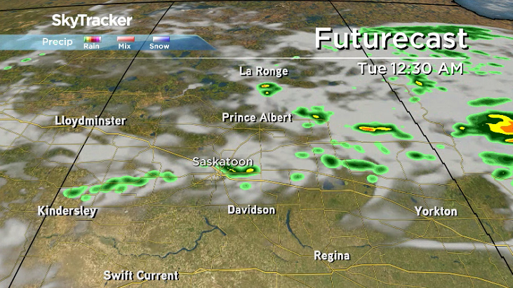
Severe Thunderstorm Watch
Environment Canada has issued a severe thunderstorm watch for the Prince Albert, North Battleford, Meadow Lake, Melfort, Nipawin, Hudson Bay, Pelican Narrows and Buffalo Narrows areas.
Conditions are favourable for the development of severe thunderstorms that may be capable of producing strong wind gusts, large hail and heavy rain.

A cold front tracking southwards across Central Saskatchewan will trigger scattered thunderstorms Monday afternoon and evening with some of these thunderstorms potentially becoming severe.
For the latest weather alerts, download the Global News SkyTracker Weather App for iPhone, iPad or Android.
Saskatoon Forecast
Monday
After a toasty weekend with daytime highs climbing into the upper 20s, heat kept pouring in for the beginning of the week.
A bit of sunshine kicked off the day before clouds rolled in before noon as temperatures popped up from their morning bottoming out point of 13 degrees to the mid-20s before noon, which felt close to 30 with humidity.
The mercury surges up even further during the afternoon into the low 30s, which will feel like the mid-30s with humidity under a mix of sun and cloud.
Monday Night
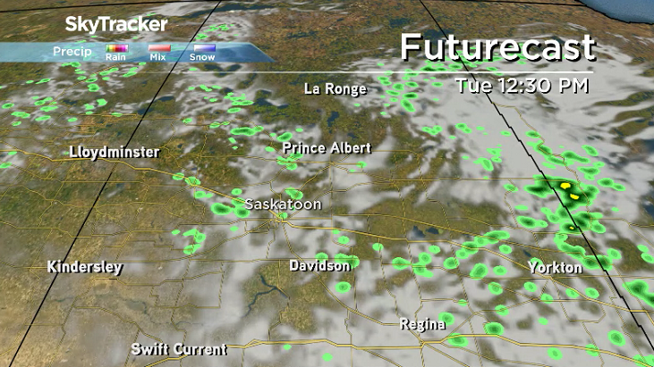
Clouds roll in Monday evening with a chance of showers and the risk of a thunderstorm overnight as a weak system ripples through and we cool back into the mid-teens.
Tuesday
There could be a few lingering clouds and the slight chance of a shower to start the day before clouds start to clear out midday and we get into some sunny breaks to wrap up the day.
Cool north-northeasterly winds will keep us cooler during the day with an afternoon high struggling to get into the mid-20s.
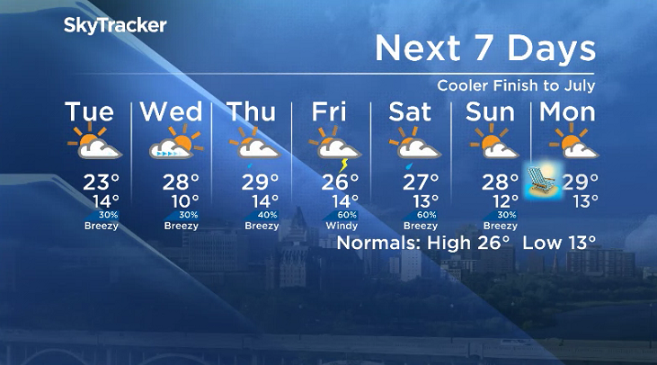
Wednesday-Friday
A building upper ridge will help push back in the heat mid-week with afternoon highs popping back into the upper 20s Wednesday and Thursday with a chance of late day showers and storms both days as clouds roll back in.


A system swinging through on Thursday will drop in cooler conditions on Friday, kicking our afternoon high back into the mid-20s under mostly cloudy skies with a good chance of thundershowers.

August Long Weekend Outlook
There still is some certainty with the August long weekend outlook, however Saturday is shaping up to be cloudier with chance of showers and thunderstorms with increasing sunshine through the weekend.
Daytime highs will gradually increase as well through the weekend, from the mid-20s on Saturday into the upper 20s by Saskatchewan Day Monday.
Colleen Clavelle took the July 30 Your Saskatchewan photo near Maple Creek:

Saskatoon weather outlook is your source for Saskatoon’s most accurate forecast and is your one stop shop for all things weather for central and northern Saskatchewan with comprehensive, in-depth analysis that you can only find here.
Comments