
A few clouds started out the week in the Central Okanagan with temperatures sitting in the low double digits, but, as sunshine started to pick up, conditions warmed into the mid 20s by noon.

It is humid enough across the region to produce a humidex that makes it feel a few degrees warmer, with an afternoon high in the upper 20s under a mix of sun and cloud.
A wave of clouds will roll in with a system Monday night and stick around into Tuesday. There is a chance of early and late day showers, which could produce a few late day thunderstorms in the Shuswap.


Get breaking National news
There is a chance that Tuesday could be one of the coldest days the Okanagan sees for the rest of July, with an afternoon high in the mid 20s.

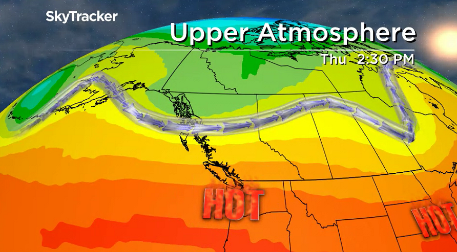
A major warm up kicks in starting Wednesday, with an upper ridge bringing in beautiful blue skies and sunshine for the rest of the week.
Temperatures will climb up toward the 30s on Wednesday and stay in the low 30s for the rest of the week before a slight cool down heading into the weekend.

For weather on the go download the Global News SkyTracker Weather App for iPhone, iPad or Android.
- Michael Kovrig reflects on ‘brutally hard’ Chinese detention: ‘You’re totally alone’
- After controversial directive, Quebec now says anglophones have right to English health services
- TD Bank moves to seize home of Russian-Canadian jailed for smuggling tech to Kremlin
- Conservatives set to table non-confidence motion Tuesday. What to expect


Comments