
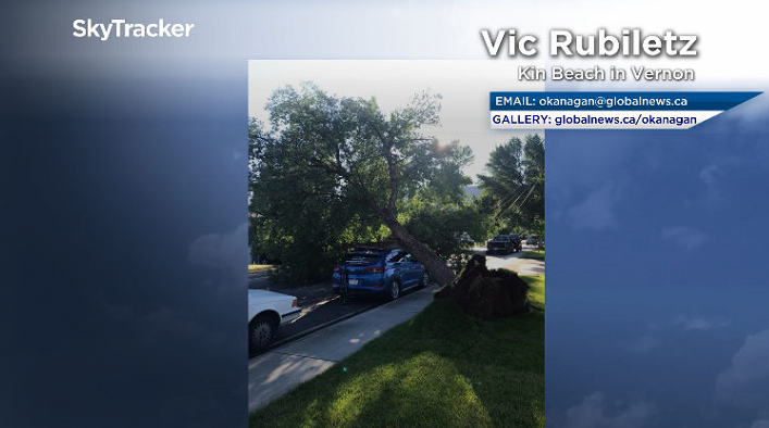
Winds blasted the Okanagan early Monday morning, leaving thousands without power after countless trees were toppled and even uprooted.

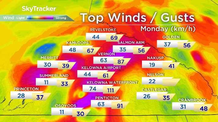
The top gust across the region was reported along the Kelowna waterfront, at 111 km/h, with gusts clocking above 90 km/h recorded in Penticton.
The culprit for the startling start to the week was a cold front smashing through the region.
It not only picked up strong and damaging wind, but also brought a dump of rain and some lightning and thunder.
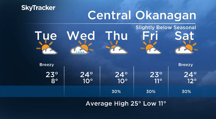
By daybreak, the sunshine had returned, winds had eased and temperatures improved to 12 degrees.
A mix of sun and cloud will dominate the remainder of the day, with a breezy southerly wind warming the region up into the mid-20s with a slight chance of late day showers.


Partly to mostly sunny skies will stick around on Tuesday before more clouds roll in Wednesday and stick around for the rest of the week. Daytime highs will rebound back into the mid-20s all week.
Cooler mornings are on tap, though, with the mercury sinking back into single digits Tuesday and Wednesday mornings before returning to double digits later on.
For the latest weather alerts download the Global News SkyTracker Weather App for iPhone, iPad or Android.
- Small grocers, co-ops receiving boost from Loblaw boycott: ‘A lot of anger’
- B.C. man losing vision needs to find home for treasured book collection
- U.K. bans generic passwords over cybersecurity concerns. Should Canada be next?
- More foreign interference action coming after inquiry report, India arrests: LeBlanc
Comments