

A gustnado was produced during Wednesday’s severe thunderstorm that tore through the Queen City.

It was caused by a strong downburst of winds that were clocked at 104 km/h.
“I was in total shock. I watched it form and thought no way,” said Pauline Gabriel who captured footage of the gustnado.
Gabriel took the video at 4:22 p.m on the corner of Arcola Avenue and Winnipeg Street. After realizing what she was witnessing, Gabriel grabbed her phone and hit record.
“I didn’t believe what I was seeing, it was pretty awe-inspiring to be honest.”

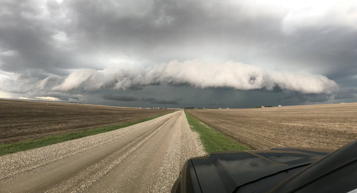
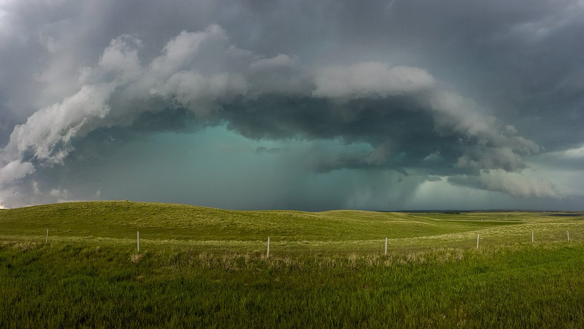
A band of severe thunderstorms developed in central Saskatchewan Wednesday afternoon and moved southeast.
Ping-pong sized hail was reported in Chaplin earlier in the afternoon.
Photos taken of the severe weather showed intense, well-structured cells embedded within a large band of thunderstorms.


The City of Moose Jaw was still cleaning up after an overnight hailstorm left mounds of hail.
A significant amount of hail fell on the city Wednesday morning, with up to 15 cm piled up in some areas.


Despite sunshine and 20 degree temperatures, mounds of hail could still be seen eight hours after the storm had passed.

Get daily National news
This caused issues as residents commuted to work and school in the morning.

Jocelyn Mariel Froehlich took the photo above of a bus stuck from all the hail accumulated in Moose Jaw after a severe thunderstorm rolled through around 3 AM Wednesday morning.
The second round of severe thunderstorms in the afternoon left Moose Jaw dealing with localized flooding.
The severe thunderstorms pushed into eastern Saskatchewan throughout Wednesday evening and weakened around 9 p.m. as they crossed into Manitoba.
READ MORE: Be prepared to deal with emergency situations in Saskatchewan
For weather-on-the-go, download the Global News Skytracker weather app for iPhone, iPad or Android.
Comments
Want to discuss? Please read our Commenting Policy first.